Marble City in Knoxville in Knox County, Tennessee — The American South (East South Central)
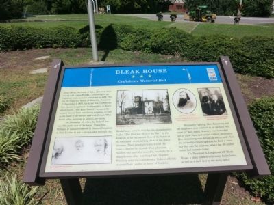
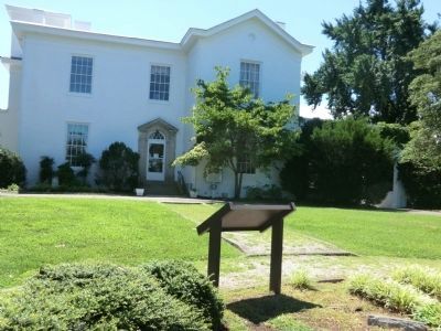
Bleak House
Confederate Memorial Hall
Photographed by Don Morfe, July 29, 2013
1. Bleak House Marker
On November 18, when the Federal line was 750 yards east of the house, Union Gen. Williams P. Sanders ordered Lt. Samuel Benjamin in Fort Loudon to put a cannon shot through the Bleak House tower to dislodge the sharpshooters. Called “The Prettiest Shot of the War” by the Federals, it hit the second floor of the house at its southeast corner, killing three of the sharpshooters. Their pencil portraits are on the tower’s interior north wall. That afternoon, Sanders was mortally wounded, reputedly by a sharpshooter, after watching Capt. Stephen Winthrop rally the Confederates. Federal officials renamed Fort Loudon in honor of Sanders.
During
this page online
On December 4, Longstreet left Bleak House, a place riddled with many bullet holes, as well as a shell scar in the main parlor.
(captions)
Drawing of Sharpshooters
Bleak House, circa 1874
Gen. James Longstreet
Mrs. Louisa Franklin Armstrong and James Longstreet, 1890
All photos courtesy Knoxville Chapter 89, United Daughters of the Confederacy
Erected by Tennessee Civil War Trails.
Topics and series. This historical marker is listed in this topic list: War, US Civil. In addition, it is included in the Tennessee Civil War Trails, and the United Daughters of the Confederacy series lists. A significant historical date for this entry is November 17, 1872.
Location. 35° 56.988′ N, 83° 57.377′ W. Marker is in Knoxville, Tennessee, in Knox County. It is in Marble City. It can be reached from Kingston
Photographed by Don Morfe, July 29, 2013
2. Bleak House Marker

Regionally, this marker is in East Tennessee. It is also in the American South, specifically in the Upper South, in Appalachia, and specifically in Southern Appalachia. Globally, it is in North America, the Western Hemisphere, the Western World, and the Anglosphere. Historically, it finds itself in what was once the original Cherokee Nation, the territory of the Mississippian Culture, one of the Confederate States of America, and the Antebellum South.
Other nearby markers. At least 8 other markers are within 2 miles of this marker, measured as the crow flies: Longstreet's Headquarters (within shouting distance of this marker); Votes for Women (approx. 0.7 miles away); War Dog Memorial (approx. 0.9 miles away); Sutherland Avenue McGhee Tyson Airport (approx. 0.9 miles away); 2111 Terrace Avenue (approx. 1.1 miles away); Medal of Honor Recipients (approx. 1.2 miles away); Confederate States of America Camp Van Dorn
Photographed by Don Morfe, July 29, 2013
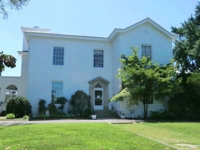
3. Bleak House
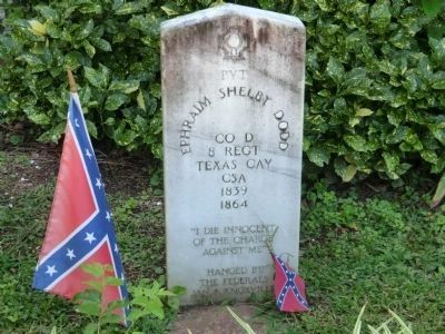
Note a Confederate grave marker near the window to the left of the entrance door
Another marker is no longer nearby. Death of Gen. William P. Sanders (was approx. 0.4 miles away but has been confirmed missing).

Photographed by Don Morfe, July 29, 2013
4. Side view of Bleak House

Photographed by Don Morfe, July 29, 2013
5. Yard in rear of Bleak House
Photographed by Don Morfe, July 29, 2013
6. Confederate grave marker near the window to the left of the entrance door
Photographed by Don Morfe, July 29, 2013
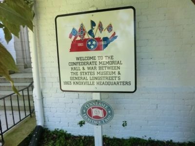
7. Sign near the entrance to Bleak House
Photographed by Don Morfe, July 29, 2013
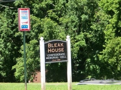
8. Bleak House Marker
Credits. This page was last revised on May 3, 2018. It was originally submitted on October 19, 2013, by Don Morfe of Baltimore, Maryland. This page has been viewed 1,460 times since then and 47 times this year. Photos: 1, 2, 3, 4, 5, 6, 7, 8. submitted on October 19, 2013, by Don Morfe of Baltimore, Maryland. • Bernard Fisher was the editor who published this page.
