University of Tennessee in Knoxville in Knox County, Tennessee — The American South (East South Central)
Fort Sanders
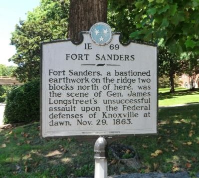
Photographed by Don Morfe, July 29, 2013
1. Fort Sanders Marker
Erected by Tennessee Historical Commission. (Marker Number 1E 69.)
Topics and series. This historical marker is listed in these topic lists: Forts and Castles • War, US Civil. In addition, it is included in the Tennessee Historical Commission series list. A significant historical month for this entry is October 1859.
Location. 35° 57.441′ N, 83° 55.83′ W. Marker is in Knoxville, Tennessee, in Knox County. It is in University of Tennessee. It is at the intersection of 16th Street and Cumberland Avenue (U.S. 70), on the left when traveling north on 16th Street. Touch for map. Marker is at or near this postal address: 631 16th St, Knoxville TN 37916, United States of America. Touch for directions.

Regionally, this marker is in East Tennessee. It is also in the American South, specifically in the Upper South, in Appalachia, and specifically in Southern Appalachia. Globally, it is in North America, the Western Hemisphere,
this page online
Other nearby markers. At least 8 other markers are within walking distance of this marker: General Clifton Bledsoe Cates (about 600 feet away, measured in a direct line); 79th New York Infantry (Highlanders) Monument (about 600 feet away); Fort Byington (about 700 feet away); James Rufus Agee (about 700 feet away); Wait Field (about 700 feet away); Fort Sanders U.D.C. Monument (approx. 0.2 miles away); Desegregation of the University of Tennessee (approx. 0.2 miles away); The Assault Upon Fort Sanders (approx. 0.2 miles away). Touch for a list and map of all markers in Knoxville.
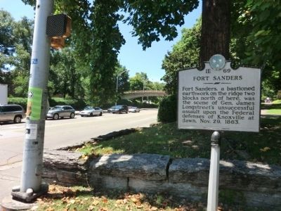
Photographed by Don Morfe, July 29, 2013
2. Fort Sanders Marker
Credits. This page was last revised on January 20, 2020. It was originally submitted on October 19, 2013, by Don Morfe of Baltimore, Maryland. This page has been viewed 1,608 times since then and 75 times this year. Photos: 1, 2. submitted on October 19, 2013, by Don Morfe of Baltimore, Maryland. • Bernard Fisher was the editor who published this page.
