Minor Hill in Giles County, Tennessee — The American South (East South Central)
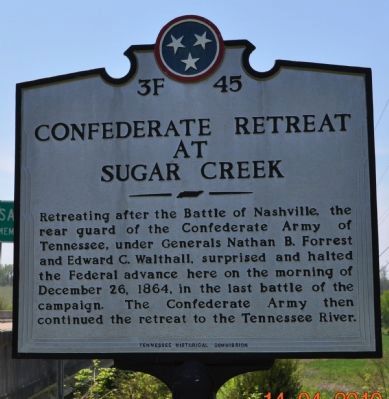
Confederate Retreat at Sugar Creek
Photographed by Sandra Hughes, April 14, 2010
1. Confederate Retreat at Sugar Creek Marker
Erected by Tennessee Historical Commission. (Marker Number 3F 45.)
Topics and series. This historical marker is listed in this topic list: War, US Civil. In addition, it is included in the Tennessee Historical Commission series list. A significant historical date for this entry is December 26, 1864.
Location. Marker has been reported missing. It was located near 35° 1.059′ N, 87° 11.845′ W. Marker was in Minor Hill, Tennessee, in Giles County. It was on Minor Hill Highway (State Highway 11), on the right when traveling south. Touch for map. Marker was in this post office area: Minor Hill TN 38473, United States of America. Touch for directions.

Regionally, this marker was in Middle Tennessee and in the Highland Rim. It was also in the American South and specifically in the Upper South.
this page online
Other nearby markers. At least 8 other markers are within 8 miles of this location, measured as the crow flies: Sam Davis Capture Site (approx. 2 miles away); Sam Davis (approx. 2 miles away); Sugar Creek Engagement (approx. 2.1 miles away); Minor Hill War Memorial (approx. 2½ miles away); Gourdsville / Gilbertsboro (approx. 6.4 miles away in Alabama); Grassy Memorial Chapel and Cemetery (approx. 6.6 miles away in Alabama); Sim Corder/Harrison Mill (approx. 6.8 miles away in Alabama); Town of Anderson (approx. 7.8 miles away in Alabama). Touch for a list and map of all markers in Minor Hill.
Another marker is no longer nearby. Noblit-Lytle House (was approx. 0.9 miles away but has been confirmed missing).
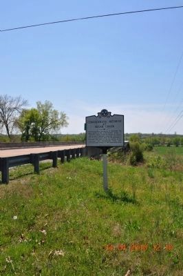
Photographed by Sandra Hughes, April 14, 2010
2. Sam Davis Bridge at Sugar Creek
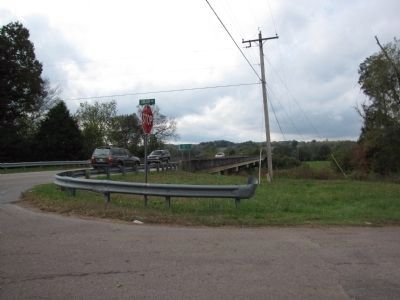
Photographed by Lee Hattabaugh, October 19, 2013
3. Confederate Retreat at Sugar Creek Marker
photo of the Sugar Creek bridge on TN-11 where the marker was located.
Credits. This page was last revised on May 16, 2025. It was originally submitted on April 15, 2010, by Sandra Hughes Tidwell of Killen, Alabama, USA. This page has been viewed 3,546 times since then and 123 times this year. Last updated on October 19, 2013, by Lee Hattabaugh of Capshaw, Alabama. Photos: 1, 2. submitted on April 15, 2010, by Sandra Hughes Tidwell of Killen, Alabama, USA. 3. submitted on October 19, 2013, by Lee Hattabaugh of Capshaw, Alabama. • Al Wolf was the editor who published this page.
