Dandridge in Jefferson County, Tennessee — The American South (East South Central)
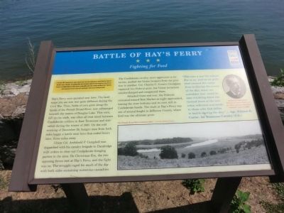
Battle of Hay's Ferry
Fighting for Food
In November 1863, Confederate Gen. James Longstreet led a force from Chattanooga to attack Union Gen. Ambrose E. Burnside’ s army at Knoxville. The campaign failed, and in December Longstreet’s men marched east along the East Tennessee and Virginia Railroad to winter quarters at Russellville, where they remained until March 1864. Numerous small engagements between Longstreet’s and Burnside’s armies occurred during the winter.
(main text)
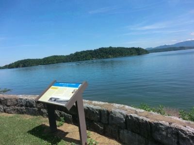
Hay’s Ferry once operated near here. The landscape you see now was quite different during the Civil War. Then, fields of corn grew along the banks of the French Broad River, now submerged beneath the waters of Douglas Lake. This corn, left on the stalk, was often all that stood between Confederate soldiers in East Tennessee and starvation during the winter of 1863. On the cold morning of December 24, hungry men from both sides began a battle near here that ended hours later, three miles away.
The Confederate cavalry, more aggressive in its tactics, pushed the Union troopers from one position to another. Col. Charles C. Crew’s Georgians captured two Federal guns, but Union horsemen countercharged and recaptured them.
Attacked front and rear, the Federals retreated toward New Market as night approached, leaving the river bottoms and its corn still in Confederate hands. The Clash at Hay’s Ferry was one of several fought in Jefferson County, where food was the ultimate prize.
“This was a sad Christmas Eve to us, and as we gathered around the campfires to discuss the events of the day, many an unbidden tear could be seen trickling down the tanned faces of the men when reference was made to those who had fallen in battle during the day.” — Sgt. William R. Carter, 1st Tennessee Cavalry (U.S.)
(captions)
The French Broad River bottoms (1941) - Courtesy Richard Taylor
William R. Carter from William R. Carter, History of the First Regiment Tennessee Volunteer Cavalry (1902)
Erected by Tennessee Civil War Trails.
Topics and series. This historical marker is listed in this topic list: War, US Civil. In addition, it is included in the Tennessee Civil War Trails series list. A significant historical year for this entry is 1863.
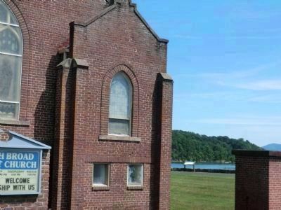
Location. 36° 2.232′ N, 83° 20.952′ W. Marker is in Dandridge, Tennessee, in Jefferson County. Marker can be reached from the intersection of Oak Grove Road and Spring Creek Road, on the left when traveling west. The marker is on the grounds of the French Broad Baptist Church. Touch for map. Marker is at or near this postal address: 2117 Oak Grove Road, Dandridge TN 37725, United States of America. Touch for directions.
Other nearby markers. At least 8 other markers are within 4 miles of this marker, measured as the crow flies. Fighting at Dandridge (approx. 1½ miles away); Stokely-Van Camp, Inc. (approx. 2.6 miles away); Pine Chapel (approx. 2.6 miles away); a different marker also named Fighting at Dandridge (approx. 3.6 miles away); McCuistion (approx. 3.7 miles away); Seabolt / Harris (approx. 3.8 miles away); The Dike That Saved Dandridge (approx. 3.9 miles away); Blant’s Hill (approx. 3.9 miles away). Touch for a list and map of all markers in Dandridge.
Credits. This page was last revised on March 16, 2017. It was originally submitted on October 20, 2013, by Don Morfe of Baltimore, Maryland. This page has been viewed 1,289 times since then and 51 times this year. Photos: 1, 2, 3, 4. submitted on October 20, 2013, by Don Morfe of Baltimore, Maryland. • Bernard Fisher was the editor who published this page.


