Mosheim in Greene County, Tennessee — The American South (East South Central)
Battle of Blue Springs
October 10, 1863
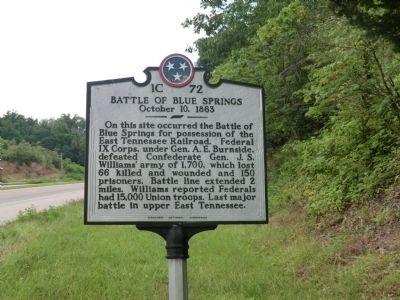
Photographed by Don Morfe, July 30, 2013
1. Battle of Blue Springs Marker
Erected by Tennessee Historical Commission. (Marker Number 1C 72.)
Topics and series. This historical marker is listed in this topic list: War, US Civil. In addition, it is included in the Tennessee Historical Commission series list.
Location. 36° 11.082′ N, 82° 55.986′ W. Marker is in Mosheim, Tennessee, in Greene County. It is at the intersection of West Andrew Johnson Highway (U.S. 11E) and Mt Pleasant Road, on the right when traveling east on West Andrew Johnson Highway. Touch for map. Marker is at or near this postal address: 6766 West Andrew Johnson Highway, Mosheim TN 37818, United States of America. Touch for directions.

Regionally, this marker is in East Tennessee. It is also in the American
this page online
Other nearby markers. At least 8 other markers are within 6 miles of this marker, measured as the crow flies: A different marker also named Battle of Blue Springs (about 600 feet away); Blue Springs Church and Cemetery (approx. 1.4 miles away); Blue Springs Lutheran Congregation (approx. 1½ miles away); Carter's Station (approx. 4.2 miles away); Pottertown Bridge Burners (approx. 4.6 miles away); Bridge Burners Monument (approx. 4.7 miles away); Execution of the "Bridge-Burners" (approx. 4.8 miles away); George Clem School (approx. 5.4 miles away). Touch for a list and map of all markers in Mosheim.
Another marker is no longer nearby. Battles of Blue Springs (was about 600 feet away, measured in a direct line but has
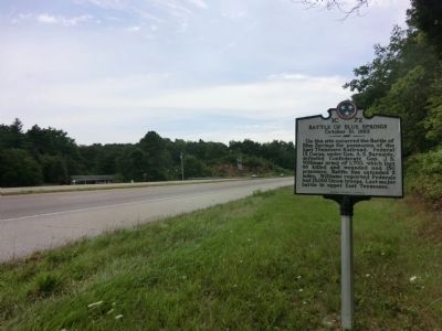
Photographed by Don Morfe, July 30, 2013
2. Battle of Blue Springs Marker
Credits. This page was last revised on January 20, 2020. It was originally submitted on October 21, 2013, by Don Morfe of Baltimore, Maryland. This page has been viewed 2,537 times since then and 130 times this year. Photos: 1, 2. submitted on October 21, 2013, by Don Morfe of Baltimore, Maryland. • Bernard Fisher was the editor who published this page.
