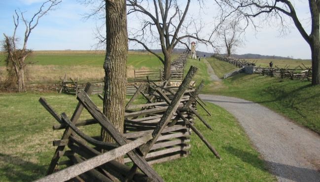
Near Sharpsburg in Washington County, Maryland — The American Northeast (Mid-Atlantic)
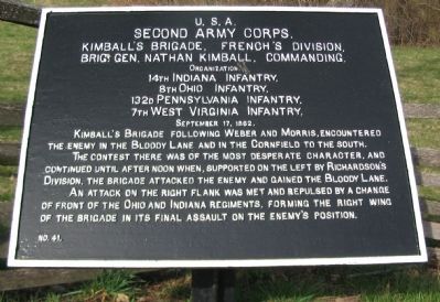
Second Army Corps
Kimball's Brigade, French's Division
Second Army Corps,
Kimball's Brigade, French's Division
Brig. Gen. Nathan Kimball, Commanding.
Organization.
14th Indiana Infantry,
8th Ohio Infantry,
132d Pennsylvania Infantry,
7th West Virginia Infantry.
September 17, 1862.
Kimball's Brigade following Weber and Morris, encountered the enemy in the Bloody Lane and in the Cornfield to the south.
The contest there was of the most desperate character, and continued until after noon when, supported on the left by Richardson's Division, the brigade attacked the enemy and gained the Bloody Lane.
An attack on the right flank was met and repulsed by a change of front of the Ohio and Indiana regiments, forming the right wing of the brigade in its final assault on the enemy's position.
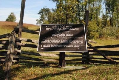
Erected by Antietam Battlefield Board. (Marker Number 41.)
Topics and series. This historical marker is listed in this topic list: War, US Civil. In addition, it is included in the Antietam Campaign War Department Markers series list. A significant historical month for this entry is September 1786.
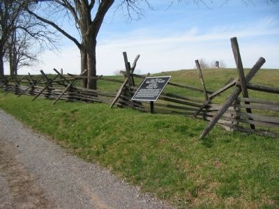
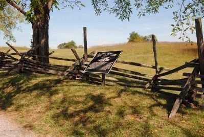
Location. 39° 28.287′ N, 77° 44.415′ W. Marker is near Sharpsburg, Maryland, in Washington County. Marker is on Richardson Avenue, on the left when traveling east . Touch for map. Marker is in this post office area: Sharpsburg MD 21782, United States of America. Touch for directions.
Other nearby markers. At least 8 other markers are within walking distance of this marker. 130th Pennsylvania Volunteer Infantry (within shouting distance of this marker); a different marker also named Second Army Corps (within shouting distance of this marker); a different marker also named Second Army Corps (within shouting distance of this marker); French's Division, Second Army Corps (within shouting distance of this marker); Jackson's Command (within shouting distance of this marker); 8th Ohio Regiment (within shouting distance of this marker); 5th Maryland Infantry (within shouting distance of this marker); The 14th Indiana Infantry (within shouting distance of this marker). Touch for a list and map of all markers in Sharpsburg.
Also see . . .
1. Antietam Battlefield. National Park Service site. (Submitted on April 7, 2008, by Craig Swain of Leesburg, Virginia.)
2. 1st Brigade, 3rd Division, II Corps. Describing the Sunken Road in his official report, Kimball wrote, The loss in my command is a lasting testimony of the sanguinary nature of the conflict, and a glance at the position held by the rebels tells how terrible was the punishment inflicted on them. The corn-fields on the front are strewn with their dead and wounded, and in the ditch first occupied by them the bodies are so numerous that they seem to have fallen dead in line of battle, for there is a battalion of dead rebels. (Submitted on April 7, 2008, by Craig Swain of Leesburg, Virginia.)
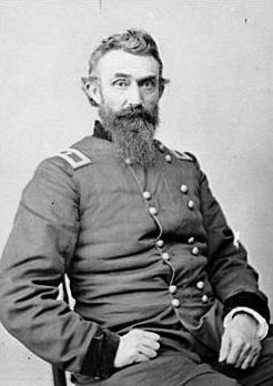
Photographed By Brian Scott
6. Brig. General Nathan Kimball (1822-1898)
His brigade formed the right of the division during its series of assaults on the Sunken Road at the Battle of Antietam, losing over 600 men killed or wounded. Despite the severe losses, the men held their ground and eventually pushed aside the Confederates in their front, capturing 300 men and several colors. Kimball's brigade became known as the "Gibraltar Brigade" for their steadfast ability to withstand enemy fire.
Credits. This page was last revised on November 24, 2017. It was originally submitted on April 7, 2008, by Craig Swain of Leesburg, Virginia. This page has been viewed 1,233 times since then and 14 times this year. Photos: 1. submitted on April 7, 2008, by Craig Swain of Leesburg, Virginia. 2. submitted on September 27, 2015, by Brian Scott of Anderson, South Carolina. 3. submitted on April 7, 2008, by Craig Swain of Leesburg, Virginia. 4. submitted on September 27, 2015, by Brian Scott of Anderson, South Carolina. 5. submitted on April 7, 2008, by Craig Swain of Leesburg, Virginia. 6. submitted on September 27, 2015, by Brian Scott of Anderson, South Carolina.
