Mechanicsville in Hanover County, Virginia — The American South (Mid-Atlantic)
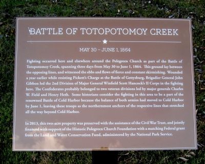
Battle of Totopotomoy Creek
May 30 - June 1, 1864
Photographed by Bernard Fisher, October 23, 2013
1. Battle of Totopotomoy Creek Marker
In 2013, this two-acre property was preserved with the assistance of the Civil War Trust, and jointly financed with the support of the Historic Polegreen Church Foundation with a matching Federal grant from the Land and Water Conservation Fund, administered
this page online
Erected 2013 by Historic Polegreen Church Foundation.
Topics. This historical marker is listed in this topic list: War, US Civil. A significant historical month for this entry is May 1859.
Location. 37° 38.756′ N, 77° 19.748′ W. Marker is in Mechanicsville, Virginia, in Hanover County. It is on Heatherwood Drive (Virginia Route 1750) 0.1 miles east of Rural Point Road ( Route 643), on the left when traveling east. Touch for map. Marker is at or near this postal address: 6404 Heatherwood Dr, Mechanicsville VA 23116, United States of America. Touch for directions.

Regionally, this marker is in Virginia’s Piedmont, in Central Virginia, and in the Richmond Metropolitan Area. It is also in the American South, specifically in the Upper South, and on the Eastern Seaboard. Globally, it is in the North Atlantic Region, North America, the Western Hemisphere, the Western World, and the Anglosphere. Historically, it finds itself in what was once the territory of the Mississippian Culture, one of the original Thirteen Colonies, one of the Confederate States of America, and the Antebellum South.
Photographed by Bernard Fisher, October 23, 2013
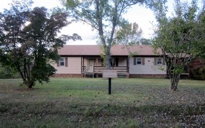
2. Battle of Totopotomoy Creek Marker
The house will eventually be removed.
Other nearby markers. At least 8 other markers are within walking distance of this marker: Historic Polegreen Church (about 300 feet away, measured in a direct line); The Polegreen Story (about 300 feet away); Welcome to Historic Polegreen Church (about 300 feet away); Polegreen Church (about 400 feet away); a different marker also named Polegreen Church (about 500 feet away); Site of Polegreen (about 500 feet away); a different marker also named Polegreen Church (about 500 feet away); The Reading Room (about 600 feet away). Touch for a list and map of all markers in Mechanicsville.
Also see . . .
1. Historic Polegreen Church Foundation. (Submitted on October 23, 2013.)
2. Civil War Trust. (Submitted on October 23, 2013.)

Photographed by Evan Dwyer, December 27, 2025
3. Battle of Totopotomoy Creek Marker
House has been removed.
Photographed by Bernard Fisher, October 23, 2013
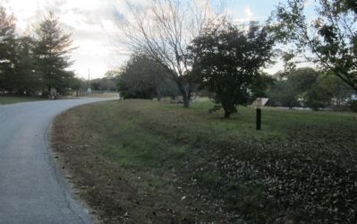
4. View towards Rural Point Road (facing west)
Credits. This page was last revised on April 9, 2026. It was originally submitted on October 23, 2013, by Bernard Fisher of Richmond, Virginia. This page has been viewed 2,164 times since then and 63 times this year. Photos: 1, 2. submitted on October 23, 2013, by Bernard Fisher of Richmond, Virginia. 3. submitted on April 5, 2026, by Evan Dwyer of Richmond, Virginia. 4. submitted on October 23, 2013, by Bernard Fisher of Richmond, Virginia.
