Blountville in Sullivan County, Tennessee — The American South (East South Central)
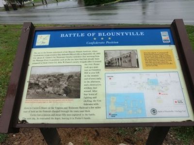
Battle of Blountville
Confederate Position
Photographed by Don Morfe, July 31, 2013
1. Battle of Blountville Marker
Carter lost a cannon and about fifty men captured in battle. The next day, he evacuated the depot, leaving it in Foster's hands.
(sidebar)
White Side Lodge No. 13 constructed the Masonic Female Institute in 1855 “to promote female education.” Jefferson Academy, the boys’ school, which stood near Cemetery Hill, contributed funds for the construction of the girls’ school. The academy was
this page online
(captions)
Blountville, looking east from near the Union position, with the Masonic Female Institute at upper right, ca. 1900 - Courtesy Sullivan Co. Archives
Masonic Female Institute, 1907 - Courtesy Hunt Library
Erected by Tennessee Civil War Trails.
Topics and series. This historical marker is listed in these topic lists: Education • War, US Civil. In addition, it is included in the Tennessee Civil War Trails series list. A significant historical month for this entry is September 1849.
Location. 36° 31.931′ N, 82° 19.526′ W. Marker is in Blountville, Tennessee, in Sullivan County. It is on Franklin Drive 0.1 miles east of Tennessee Route 394, on the right when traveling east. Touch for map. Marker is in this post office area: Blountville TN 37617, United States of America. Touch for directions.

Regionally, this marker is in East Tennessee and in the Tri-Cities Area. It is also in the American South, specifically in the Upper South, in Appalachia, and specifically in Southern Appalachia. Globally, it is in North
Photographed by Don Morfe, July 31, 2013
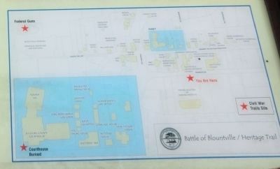
2. Battle of Blountville / Heritage Trail map
Other nearby markers. At least 8 other markers are within walking distance of this marker: Anderson Townhouse (about 300 feet away, measured in a direct line); The Cannonball House (about 400 feet away); Old Deery Inn (about 400 feet away); Ralph Blizard (about 400 feet away); a different marker also named Old Deery Inn (about 400 feet away); Sullivan County Veterans Memorial (about 500 feet away); Tipton Town House (about 500 feet away); a different marker also named Battle of Blountville (about 500 feet away). Touch for a list and map of all markers in Blountville.
Photographed by Don Morfe, July 31, 2013
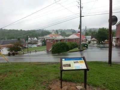
3. Battle of Blountville Marker
Credits. This page was last revised on June 16, 2016. It was originally submitted on October 28, 2013, by Don Morfe of Baltimore, Maryland. This page has been viewed 1,317 times since then and 70 times this year. Photos: 1, 2, 3. submitted on October 28, 2013, by Don Morfe of Baltimore, Maryland. • Bernard Fisher was the editor who published this page.
