Downtown in Tucson in Pima County, Arizona — The American Mountains (Southwest)
Scott Avenue
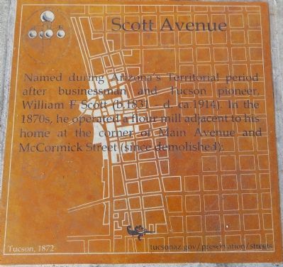
Photographed by Bill Kirchner, October 27, 2013
1. Scott Avenue Marker
Erected 2013 by City of Tucson Historic Preservation Office.
Topics. This historical marker is listed in this topic list: Roads & Vehicles.
Location. 32° 13.32′ N, 110° 58.184′ W. Marker is in Tucson, Arizona, in Pima County. It is in Downtown. It is at the intersection of East Congress Street and Scott Avenue, on the right when traveling west on East Congress Street. Marker is mounted horizontally in the sidewalk, on the northeast corner of the intersection. Touch for map. Marker is at or near this postal address: 87 E Pennington St, Tucson AZ 85701, United States of America. Touch for directions.

Regionally, this marker is in the Sky Islands, in the Sonoran Desert, and in the Phoenix Metropolitan Area. It is also in the American Borderlands and in the Southwest. Globally, it is in North America, the Western Hemisphere, the
this page online
Other nearby markers. At least 8 other markers are within walking distance of this marker: A different marker also named Scott Avenue (about 400 feet away, measured in a direct line); Pennington Street (about 400 feet away); Congress Street (about 500 feet away); Roy Place "Montgomery Ward" Building (about 500 feet away); Fox Tucson Theatre (about 600 feet away); Jácome’s (about 600 feet away); Charles O. Brown House (about 800 feet away); a different marker also named Congress Street (about 800 feet away). Touch for a list and map of all markers in Tucson.
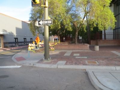
Photographed by Bill Kirchner, October 27, 2013
2. Scott Avenue Marker
View north from Congress Street. Scott Avenue is the narrow street on the left.
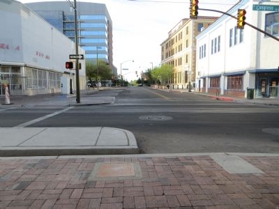
Photographed by Bill Kirchner, October 27, 2013
3. Scott Avenue Marker
View south, on Scott Avenue, across East Congress Street.
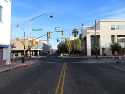
Photographed by Bill Kirchner, October 27, 2013
4. Scott Avenue
Credits. This page was last revised on June 16, 2016. It was originally submitted on October 29, 2013, by Bill Kirchner of Tucson, Arizona. This page has been viewed 1,189 times since then and 67 times this year. Photos: 1, 2, 3, 4. submitted on October 29, 2013, by Bill Kirchner of Tucson, Arizona. • Syd Whittle was the editor who published this page.
