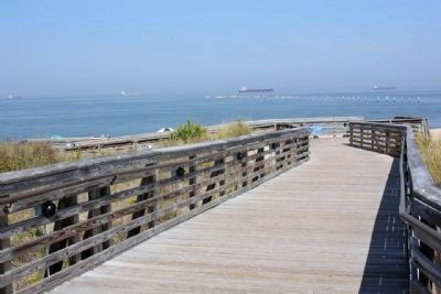
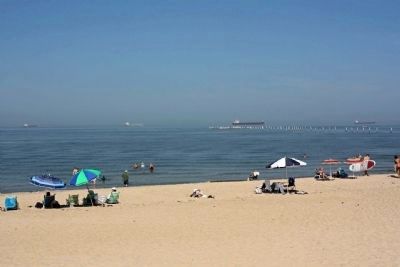
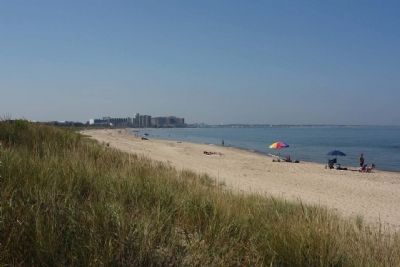
Cape Henry in Virginia Beach, Virginia — The American South (Mid-Atlantic)
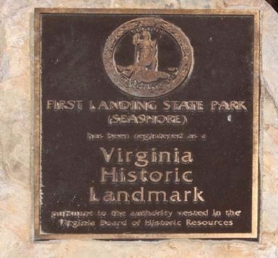
First Landing State Park
First Landing State Park
(Seashore)
has been registered as a
Virginia
Historic
Landmark
pursuant to the authority vested in the
Virginia Board of Historic
Resources
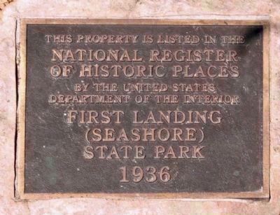
Right Plaque
This property is listed in the
National Register
Of Historic Places
By the United States
Department Of The Interior
First Landing
(Seashore)
State Park
1936
Topics and series. This historical marker is listed in these topic lists: Colonial Era • Exploration • Settlements & Settlers. In addition, it is included in the Civilian Conservation Corps (CCC) series list. A significant historical year for this entry is 1936.
Location. 36° 55.115′ N, 76° 3.213′ W. Marker is in Virginia Beach, Virginia. It is in Cape Henry. Touch for map. Marker is at or near this postal address: 2500 Shore Drive, Virginia Beach VA 23451, United States of America. Touch for directions.
Other nearby markers. At least 8 other markers are within 2 miles of this marker, measured as the crow flies. The Virginia Company (here, next to this marker); Land Ho! (within shouting distance of this marker); Civilian Conservation Corps Company 1371 (within shouting distance of this marker); Seashore State Park (about 400 feet away, measured in a direct line); The Discovery (approx. 0.2 miles away); George Kendall (approx. 0.2 miles away); Chesapeake Indians (approx. 1˝ miles away); Meeting of Three Commanders (approx. 1.6 miles away). Touch for a list and map of all markers in Virginia Beach.
Regarding First Landing State Park. This park was developed by the National Park Service, Interior Department, through the Civilian Conservation Corps, in conjunction with the Virginia Conservation Commission. It covers 3400 acres and was opened, June 15, 1936. Two miles west is Lynhaven Bay, in or near which there were naval actions in 1672 and 1700, and naval movements in 1781 and 1813. (Virginia Conservation Commission)
Also see . . . Seashore State Park Historic District. Virginia Department of Historic Resources entry (Submitted on October 30, 2013, by Mike Stroud of Bluffton, South Carolina.)
Additional commentary.
1. National Register of Historic Places:
Seashore State Park Historic District (added 2005 - - #05001267)
Also known as First Landing State Park; 134-0099
2500 Shore Dr. , Virginia Beach (Independent City)
♦ Historic Significance: Architecture/Engineering, Event
♦ Architect, builder, or engineer: NPS, et al., CEGG Assoc. LC
♦ Architectural Style: Modern Movement
♦ Area of Significance: Architecture, Entertainment/Recreation, Landscape Architecture
♦ Period of Significance: 1925-1949
♦ Owner: State
♦ Historic Function: Commerce/Trade, Domestic, Recreation And Culture, Transportation
♦ Historic Sub-function: Department Store, Hotel, Outdoor Recreation, Outdoor Recreation, Pedestrian Related, Restaurant, Road-Related
♦ Current Function: Commerce/Trade, Domestic, Landscape, Recreation And Culture, Transportation
— Submitted October 30, 2013, by Mike Stroud of Bluffton, South Carolina.
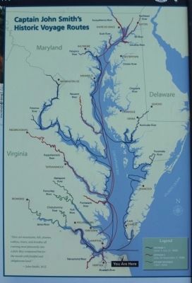
Photographed By National Park Service, `
8. First Landing State Park , Captain John Smith Chesapeake National Historic Trail
"Here are mountains,hils,(sic)plaines,valleys, rivers and brookes all running most pleasantly into a faire Bay compassed but for the mouth with fruitful and delightsome land." — John Smith, 1612
Credits. This page was last revised on February 1, 2023. It was originally submitted on October 30, 2013, by Mike Stroud of Bluffton, South Carolina. This page has been viewed 814 times since then and 45 times this year. Photos: 1, 2, 3, 4, 5, 6, 7. submitted on October 30, 2013, by Mike Stroud of Bluffton, South Carolina. 8. submitted on October 31, 2013, by Mike Stroud of Bluffton, South Carolina.
