Rock Hall in Kent County, Maryland — The American Northeast (Mid-Atlantic)
Bounty Below
Photographed by Don Morfe, October 27, 2013
1. Bounty Below Marker
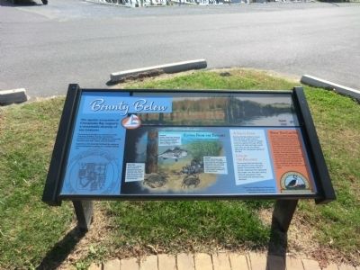
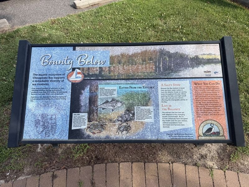
The aquatic ecosystem of Chesapeake Bay supports a remarkable diversity of sea creatures.
From bottom-dwellers to swimmers to reef-clutching shellfish, the Bay environment produces more than $175 million in commercial harvests each year. That’s a lot of seafood!
Experience this diversity firsthand by eating at a local restaurant or going on a charter fishing trip.
Eating From the Estuary
Blue Crab
At their most delicious after a summer of growing fat and heavy, Maryland's blue crabs are famous for their sweet flesh. Did you know that a third of America's blue crab harvest comes from the Chesapeake Bay?
Rockfish (striped bass), Maryland’s state fish is also the Bay’s premier sport and commercial species. Silver-flanked with iridescent stripes, rockfish is a challenge to catch and a delight to eat.
Oysters Oysters, a sign of Bay health, do their own part by eating algae and filtering Bay water. Controlling erosion from upstream sources keeps young oysters from smothering under layers of silt, helping stabilize populations of this delicious food.
A Salty Stew Because the Bay bottom is lower than sea
this page online
Life in the Balance
The animals that live here are well adapted to this changing aquatic environment. But as human influences have disrupted Bay health over the past century, seafood populations have decreased and harvests have declined.
What You Can Do
More than 15 million people live in the Chesapeake Bay watershed, which stretches from New York to Virginia and the entire District of Columbia. Everyone who lives in the watershed is just a few minutes from one or more of the 100,000 streams or rivers draining into the Bay. From planting erosion-controlling strips of vegetation, to composting, to reducing pesticide use, our cumulative actions can turn the tide and help make the Bay a healthier place. You can make an impact, and see it on your plate!
Erected by Chesapeake Country National Scenic Byway.
Topics. This historical marker is listed in these topic lists: Animals • Waterways & Vessels.
Location. 39° 8.112′ N,
Photographed by Devry Becker Jones (CC0), June 13, 2026
2. Bounty Below Marker
Unfortunately the marker has weathered, although it remains generally legible.

Regionally, this marker is on the Eastern Shore. It is also in the American Mid-Atlantic, on the Delmarva Peninsula, in the Tidewater, in the Chesapeake Bay Region, and on the Eastern Seaboard. Globally, it is in the North Atlantic Region, North America, the Western Hemisphere, the Western World, and the Anglosphere. Historically, it finds itself in what was once one of the original Thirteen Colonies and also the Antebellum South.
Other nearby markers. At least 8 other markers are within walking distance of this marker: Right Place, Right Time (here, next to this marker); Attracted By Bounty (here, next to this marker); Rock Hall Landing (approx. 0.3 miles away); Red Nun #6 (approx. 0.4 miles away); A Diversion (approx. 0.6 miles away); Rock Hall, Maryland (approx. 0.7 miles away); Gratitude (approx. 0.7 miles away); Veterans Memorial (approx. ¾
Photographed by Don Morfe, October 27, 2013
3. Bounty Below Marker
Photographed by Don Morfe, October 27, 2013
4. Bounty Below Marker
Credits. This page was last revised on June 14, 2026. It was originally submitted on November 1, 2013, by Don Morfe of Baltimore, Maryland. This page has been viewed 560 times since then and 27 times this year. Photos: 1. submitted on November 1, 2013, by Don Morfe of Baltimore, Maryland. 2. submitted on June 14, 2026, by Devry Becker Jones of Washington, District of Columbia. 3, 4. submitted on November 1, 2013, by Don Morfe of Baltimore, Maryland. • Bill Pfingsten was the editor who published this page.
