Rock Hall in Kent County, Maryland — The American Northeast (Mid-Atlantic)
Attracted By Bounty
Photographed by Don Morfe, October 27, 2013
1. Attracted By Bounty Marker
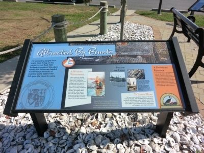
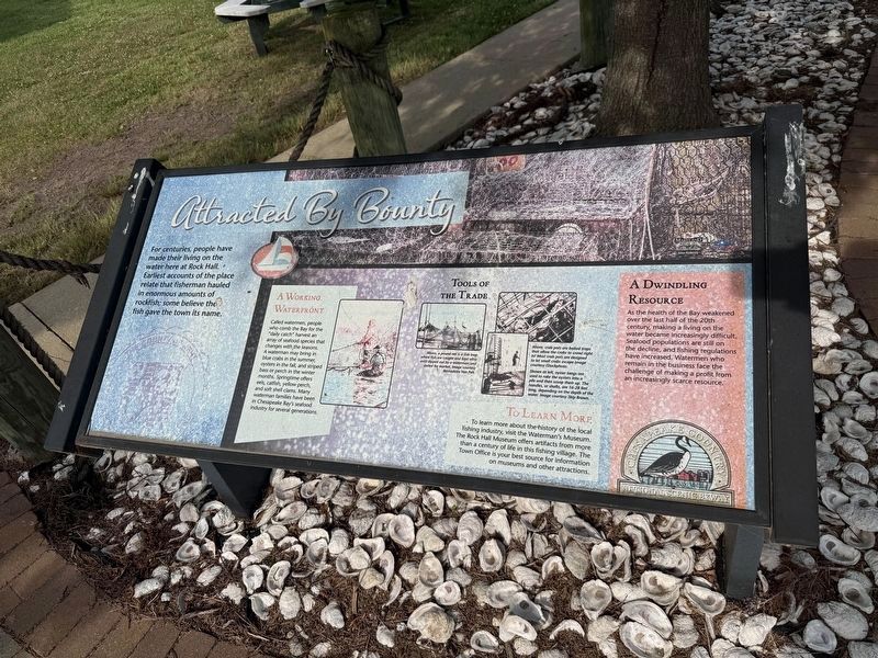
For centuries, people have made their living on the water here at Rock Hall. Earliest accounts of the place relate that fisherman hauled in enormous amounts of rockfish; some believe the fish gave the town its name.
A Working Waterfront
Called waterman, people who comb the Bay for the “daily catch” harvest an array of seafood species that changes with the seasons. A waterman may bring in blue crabs in the summer, oysters in the fall, and striped bass or perch in the winter months. Springtime offers eels, catfish, yellow perch, and soft shell claims. Many waterman families have been in Chesapeake Bay’s seafood industry for several generations.
To Learn More
To learn more about the history of the local fishing industry, visit the Waterman’s Museum. The Rock Hall Museum offers artifacts from more than a century of life in this fishing village. The Town Office is your best source for information on museums and other attractions.
A Dwindling Resource
As the health of the Bay weakened over the last half of the 20th century, making a living on the water became increasingly difficult. Seafood populations are still
this page online
Rock Hall’s annual Waterman’s Day is a Fourth of July tradition celebrating the men and women who make their living from local waters.
Tools of the Trade
Above, a pound net is a fish trap where fish are caught and kept alive until dipped out by a waterman and sorted for market. Image courtesy Bernadette Van Pelt.
Above, crab pots are baited traps that allow the crabs to crawl right in! Most crab pots are designed to let small crabs escape. Image courtesy iStockphoto. Shown on the left, oyster tongs are used to rake the oysters into a pile and then scoop them up. The handles, or shafts, are 16-28 feet long, depending on the depth of the water. Image courtesy Skip Brown.
Erected by Chesapeake Country National Scenic Byway.
Topics. This historical marker is listed in these topic lists: Industry & Commerce • Waterways & Vessels.
Location. 39° 8.113′ N, 76° 14.886′ W. Marker is in Rock Hall, Maryland,
Photographed by Devry Becker Jones (CC0), June 13, 2026
2. Attracted By Bounty Marker
Unfortunately the marker has weathered, although it remains generally legible.

Regionally, this marker is on the Eastern Shore. It is also in the American Mid-Atlantic, on the Delmarva Peninsula, in the Tidewater, in the Chesapeake Bay Region, and on the Eastern Seaboard. Globally, it is in the North Atlantic Region, North America, the Western Hemisphere, the Western World, and the Anglosphere. Historically, it finds itself in what was once one of the original Thirteen Colonies and also the Antebellum South.
Other nearby markers. At least 8 other markers are within walking distance of this marker: Right Place, Right Time (here, next to this marker); Bounty Below (here, next to this marker); Rock Hall Landing (approx. 0.3 miles away); Red Nun #6 (approx. 0.4 miles away); A Diversion (approx. 0.6 miles away); Rock Hall, Maryland (approx. 0.7 miles away); Gratitude (approx. 0.7 miles away); Veterans Memorial (approx. ¾ mile away). Touch for a list and map of all markers in Rock Hall.
Photographed by Don Morfe, October 27, 2013
3. Attracted By Bounty Marker
Photographed by Don Morfe, October 27, 2013
4. Attracted By Bounty Marker
Credits. This page was last revised on June 14, 2026. It was originally submitted on November 2, 2013, by Don Morfe of Baltimore, Maryland. This page has been viewed 617 times since then and 25 times this year. Photos: 1. submitted on November 2, 2013, by Don Morfe of Baltimore, Maryland. 2. submitted on June 14, 2026, by Devry Becker Jones of Washington, District of Columbia. 3, 4. submitted on November 2, 2013, by Don Morfe of Baltimore, Maryland. • Bill Pfingsten was the editor who published this page.
