San Luis Obispo in San Luis Obispo County, California — The American West (Pacific Coastal)
San Luis Obispo Creek
Inscription.
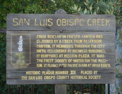
Creek rises up in Cuesta Canyon and is joined by a creek from Reservoir Canyon. It meanders through the city until its (sic) covered by business buildings. It reappears at Mission Plaza. It was the first source of water for the mission. It flows into Pacific Ocean at Avila Beach.
Historic Plaque Number XII place by the San Luis Obispo County Historical Society
Erected by San Luis Obispo County Historical Society. (Marker Number 12.)
Topics. This historical marker is listed in this topic list: Waterways & Vessels.
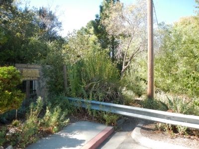
Location. 35° 16.873′ N, 120° 39.373′ W. Marker is in San Luis Obispo, California, in San Luis Obispo County. Marker is on Toro Street south of Marsh Street, on the right when traveling south. Touch for map. Marker is at or near this postal address: 1301 Toro Street, San Luis Obispo CA 93401, United States of America. Touch for directions.
Other nearby markers. At least 8 other markers are within walking distance of this marker. Dallidet Adobe (within shouting distance of this marker); The Ramona Hotel Depot (within shouting distance of this marker); Presbyterian Church (approx. ¼ mile away); J. P. Andrews Building (approx. 0.3 miles away); Site of First County Court House (approx. 0.3 miles away); Southern Pacific Water Tower (approx. 0.4 miles away); San Luis Obispo Sesquicentennial (approx. 0.4 miles away); General John C. Fremont (approx. 0.4 miles away). Touch for a list and map of all markers in San Luis Obispo.
Credits. This page was last revised on June 16, 2016. It was originally submitted on November 7, 2013, by Barry Swackhamer of Brentwood, California. This page has been viewed 420 times since then and 12 times this year. Photos: 1, 2. submitted on November 7, 2013, by Barry Swackhamer of Brentwood, California. • Al Wolf was the editor who published this page.

