Avila Beach in San Luis Obispo County, California — The American West (Pacific Coastal)
Point San Luis Light Station
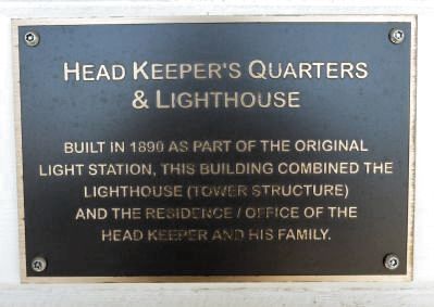
Head Keeper’s Quarters & Lighthouse
Photographed by Sue Swackhamer, October 6, 2013
1. Head Keeper’s Quarters & Lighthouse Marker
Built in 1890 as part of the original light station, this building combined the lighthouse (tower structure) and the residence/office of the head keeper and his family.
Topics and series. This historical marker is listed in these topic lists: Communications • Waterways & Vessels. In addition, it is included in the Lighthouses series list. A significant historical year for this entry is 1890.
Location. 35° 9.621′ N, 120° 45.65′ W. Marker is in Avila Beach, California, in San Luis Obispo County. It can be reached from Lighthouse Road. Touch for map. Marker is in this post office area: Avila Beach CA 93424, United States of America. Touch for directions.

Regionally, this marker is on the Central Coast and specifically on the Coast Ranges. It is also on the American Pacific Coast. Globally, it is in North America, on the Ring of Fire, in the Pacific Rim, in the Western Hemisphere, in the Western World, and in the Anglosphere. Historically, it finds itself in what was once New Spain and also Mexico’s Alta California.
Other nearby markers. At least 8 other markers are within 7 miles of this marker, measured
this page online
More about this marker. This light station is located on Point San Luis near Avila Beach, CA. Access is by tour only.
Also see . . .
1. The Point San Luis Lighthouse. Website homepage (Submitted on November 7, 2013, by Barry Swackhamer of Brentwood, California.)
2. Point San Luis Lighthouse. Wikipedia entry (Submitted on August 8, 2023, by Larry Gertner of New York, New York.)
Additional keywords. lighthouse
Photographed by Sue Swackhamer, October 6, 2013
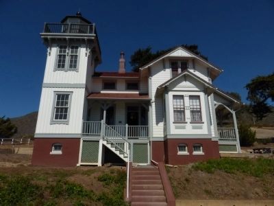
2. Point San Luis Light Station Marker
The marker is located on the porch.
via NPS, unknown
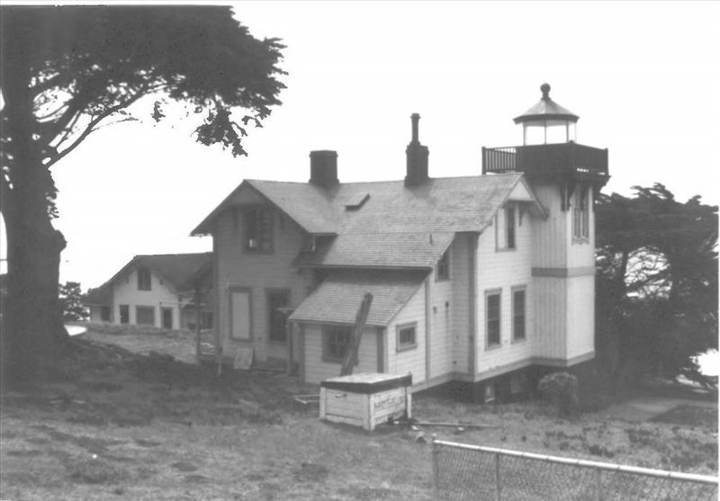
3. San Luis Obispo Light Station
National Register of Historic Places Registration Form
at NPGallery Digital Asset Management System
Click for more information.
at NPGallery Digital Asset Management System
Click for more information.
Photographed by Sue Swackhamer, October 6, 2013
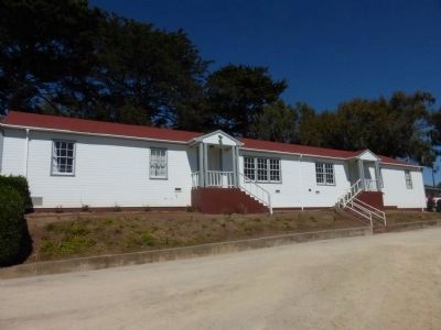
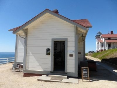
4. West Duplex Building
The plaque, located between the two entrances, reads:
Built in 1963 by the Coast Guard as a replacement structure for the original 1890 Victorian duplex at this same location. To clear the site, the original structure was pushed over the coast bluff below.
Built in 1963 by the Coast Guard as a replacement structure for the original 1890 Victorian duplex at this same location. To clear the site, the original structure was pushed over the coast bluff below.
Photographed by Sue Swackhamer, October 6, 2013
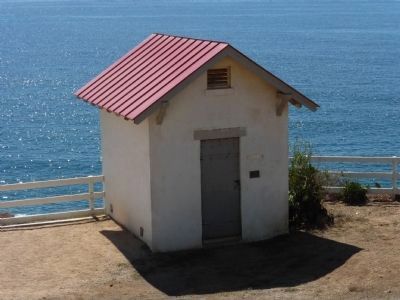
5. Fog Signal Building
The plaque on this building reads:
Built in 1890 as part of the original light station, this structure was also called the Whistle House, the later the Horn House. It was always the building that generated the audio component for the Point San Luis Light Station.
Built in 1890 as part of the original light station, this structure was also called the Whistle House, the later the Horn House. It was always the building that generated the audio component for the Point San Luis Light Station.
Photographed by Sue Swackhamer, October 6, 2013
6. Oil House
The plaque on the building reads:
Built in 1890 as part of the original light station, this building, constructed of brick with an iron door to reduce the hazard of fire, was used to store lamp oil for the light and other flammables.
Built in 1890 as part of the original light station, this building, constructed of brick with an iron door to reduce the hazard of fire, was used to store lamp oil for the light and other flammables.
Credits. This page was last revised on August 8, 2023. It was originally submitted on November 7, 2013, by Barry Swackhamer of Brentwood, California. This page has been viewed 811 times since then and 20 times this year. Photos: 1, 2. submitted on November 7, 2013, by Barry Swackhamer of Brentwood, California. 3. submitted on August 8, 2023, by Larry Gertner of New York, New York. 4, 5, 6. submitted on November 7, 2013, by Barry Swackhamer of Brentwood, California. • Al Wolf was the editor who published this page.
