Near Yreka in Siskiyou County, California — The American West (Pacific Coastal)
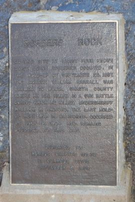
Robbers Rock
Dedicated by
Humbug Chapter No. 73
E Clampus Vitus
September 8, 1979
Erected 1979 by E Clampus Vitus, Humbug Chapter 73.
Topics and series. This historical marker is listed in this topic list: Roads & Vehicles. In addition, it is included in the E Clampus Vitus series list. A significant historical month for this entry is July 2005.
Location. 41° 40.68′ N, 122° 43.315′ W. Marker is near Yreka, California, in Siskiyou County. Marker is on Fort Jones Road (California Route 3), on the left when traveling south. Touch for map. Marker is in this post office area: Yreka CA 96097, United States of America. Touch for directions.
Other nearby markers. At least 8 other markers are within 6 miles of this marker, measured as the crow flies. Greenhorn (approx. 4.2 miles away); Moonlit Oaks Dance Pavilion / Clyde Johnson Lynching (approx. 4.3 miles away); No. 4 Kingpin Hydraulic Giant (approx. 5.4 miles away); Yreka Trail – A Mighty Town (approx. 5.6 miles away); Thompson’s Dry Diggings (approx. 5.6 miles away); First Log House (approx. 5.6 miles away); Randolph Collier (approx. 5.7 miles away); Carnegie Library Building (approx. 5.7 miles away). Touch for a list and map of all markers in Yreka.
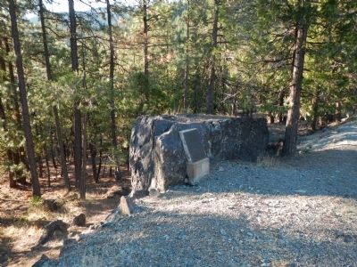
More about this marker. This marker is located on a small gravel side-road (driveway?), but visible from Highway 3, about 200 yards north of the Forest Summit.
Also see . . . Robbers Rock - Yreka History blogspot. It was a warm afternoon on July 5, 1908, the three gentlemen passengers and one lady passenger jostled along in the Fort Jones bound stage. The team of horses and the passengers had nearly made it to the top of the pass from Yreka. (Submitted on November 16, 2013, by Barry Swackhamer of Brentwood, California.)
Additional keywords. robbery
Credits. This page was last revised on June 16, 2016. It was originally submitted on November 16, 2013, by Barry Swackhamer of Brentwood, California. This page has been viewed 879 times since then and 95 times this year. Photos: 1, 2. submitted on November 16, 2013, by Barry Swackhamer of Brentwood, California. • Al Wolf was the editor who published this page.

