
Petersburg, Virginia — The American South (Mid-Atlantic)
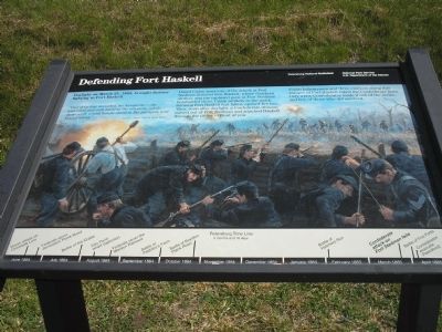
Defending Fort Haskell
Photographed By Bill Coughlin, April 23, 2007
1. Defending Fort Haskell Marker
“Our thin line mounted the banquette – the wounded and sick loading the muskets, while those with sound hands stood to the parapets and blazed away.”
- George L. Kilmer, 14th N.Y. Heavy Artillery
Dazed Union survivors of the attack at Fort Stedman jammed into Haskell, where Southern artillery and the captured guns at Fort Stedman bombarded them. Union artillery to the south, thinking Fort Haskell had fallen, opened fire too. Then, soon after daylight, a Confederate division moved out of Fort Stedman and attacked Haskell through the ravine in front of you.
Union Infantrymen and three cannons along this parapet of Fort Haskell raked the Confederate lines. Only a few Confederates made it out of the ravine, and few of those who did survived.
Erected by Petersburg National Battlefield - National Park Service - Dept. of the Interior.
Topics. This historical marker is listed in this topic list: War, US Civil. A significant historical date for this entry is March 25, 1865.
Location. 37° 13.612′ N, 77° 22.16′ W. Marker is in Petersburg, Virginia. Marker is on Siege Road, on the right when traveling south. Marker is in Petersburg National Battlefield on
this page online
Other nearby markers. At least 8 other markers are within walking distance of this marker. Gracie’s Salient (approx. 0.3 miles away); Fort Stedman (approx. 0.3 miles away); a different marker also named Fort Stedman (approx. 0.3 miles away); A Final Effort (approx. 0.3 miles away); Siege of Petersburg—Lee Strikes Back (approx. 0.3 miles away); Wasted Valor (approx. 0.4 miles away); Colquitt’s Salient (approx. 0.4 miles away); a different marker also named Colquitt's Salient (approx. 0.4 miles away). Touch for a list and map of all markers in Petersburg.
More about this marker. The background of the marker is a painting of Union soldiers defending Fort Haskell from the attacking Confederates.
The bottom of the marker, like many others in Petersburg National Battlefield, features a Petersburg Time Line, including the failed attack on Fort Stedman.
Also see . . .
1. Fort Stedman. CWSAC Battle Summaries. (Submitted on April 12, 2008, by Bill Coughlin of Woodland Park, New Jersey.)
2. Petersburg National Battlefield. National Park Service. (Submitted on April 12, 2008, by Bill Coughlin of Woodland Park, New Jersey.)
3. The Siege of Petersburg. (Submitted on April 12, 2008, by Bill Coughlin of Woodland Park, New Jersey.)
Photographed By Bill Coughlin, April 23, 2007
2. Fort Haskell Marker
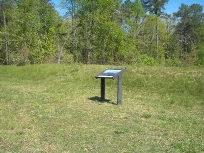
Union artillery and infantry fire here stopped the Confederate advance during the Battle for Fort Stedman.
Photographed By Bill Coughlin, April 23, 2007
3. Fort Stedman
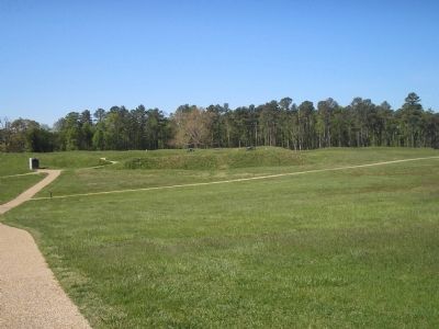
After taking Fort Stedman, Confederate forces proceeded south toward Fort Haskell but were driven back by the Union troops there.
Credits. This page was last revised on February 2, 2023. It was originally submitted on April 12, 2008, by Bill Coughlin of Woodland Park, New Jersey. This page has been viewed 2,503 times since then and 28 times this year. Photos: 1, 2, 3. submitted on April 12, 2008, by Bill Coughlin of Woodland Park, New Jersey. • Craig Swain was the editor who published this page.

