Mansfeld-Lutherstadt in Mansfeld-Südharz, Saxony-Anhalt, Germany — Central Europe
Mansfeld Brunnen
⎯⎯⎯
Well
Photographed by William Fischer, Jr., September 24, 2013
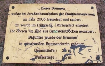
1. Mansfeld Brunnen / Well Marker
Gesamttiefe: 23 m
Wassertiefe: 15 m
——————————
This well was uncovered during road construction work in the town center redevelopment in 2003 and renovated. It was created in the early 17th century. The upper 7m are built of sandstone blocks. The well was lined with new red sandstone.
Total depth: 23 m
Water depth: 15 m
Topics. This historical marker is listed in these topic lists: Man-Made Features • Settlements & Settlers. A significant historical year for this entry is 2003.
Location. 51° 35.563′ N, 11° 27.103′ E. Marker is in Mansfeld-Lutherstadt, Sachsen-Anhalt (Saxony-Anhalt), in Mansfeld-Südharz. It is on Lutherstraße 0.1 kilometers Junghuhnstraße, on the right when traveling south. Touch for map. Marker is at or near this postal address: Lutherstraße 9, Mansfeld-Lutherstadt ST 06343,
this page online

Regionally, this marker is in Central Germany and in the Harz. Globally, it is in Europe, the European Union, Atlantic Europe, Central Europe, the Schengen Area, Western Europe, and the Western World. Historically, it finds itself in what was once the Holy Roman Empire and also the former East Germany.
Other nearby markers. At least 8 other markers are within walking distance of this marker: Luther Fountain / Lutherbrunnen (within shouting distance of this marker); Scherren (about 90 meters away, measured in a direct line); Mittelalterliches Straßenpflaster (about 90 meters away); Mansfeld um / in 1560 (about 90 meters away); St. George's, Martin Luther's Home Church (about 90 meters away); War Memorial (about 90 meters away); Luthers Schule / Luther's School (about 120 meters away); a different marker also named Luthers Schule / Luther's School (about 120 meters away). Touch for a list and map of all markers in Mansfeld-Lutherstadt.
Also see . . . History of Mansfeld, Germany. (Submitted on November 24, 2013, by William Fischer, Jr. of Reynoldsburg, Ohio.)
Photographed by William Fischer, Jr., September 24, 2013
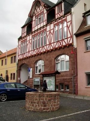
2. Mansfeld Brunnen / Well Marker
Credits. This page was last revised on January 28, 2022. It was originally submitted on November 24, 2013, by William Fischer, Jr. of Reynoldsburg, Ohio. This page has been viewed 436 times since then and 10 times this year. Photos: 1, 2. submitted on November 24, 2013, by William Fischer, Jr. of Reynoldsburg, Ohio.
