Mexico in Audrain County, Missouri — The American Midwest (Upper Plains)
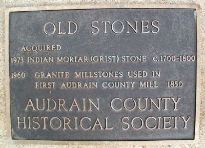
Old Stones
Acquired
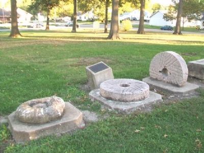
1973 Indian Mortar (Grist) Stone c.1700-1800
1960 Granite Millstones used in first Audrain County mill 1850
Erected by Audrain County Historical Society.
Topics. This historical marker is listed in these topic lists: Industry & Commerce • Native Americans • Settlements & Settlers. A significant historical year for this entry is 1973.
Location. 39° 10.083′ N, 91° 53.365′ W. Marker is in Mexico, Missouri, in Audrain County. Marker can be reached from Missouri Route 15. Stones are part of the Museum of Audrain County complex, on the grounds of Robert S. Green Park. Touch for map. Marker is at or near this postal address: 501 South Mudrow Street, Mexico MO 65265, United States of America. Touch for directions.
Other nearby markers. At least 8 other markers are within walking distance of this marker. Hardin College Bell (within shouting distance of this marker); Old Courthouse Clock Bell (within shouting distance of this marker); Bean Creek German Evangelical Church and Littleby Methodist Church Bell (within shouting distance of this marker); Graceland (within shouting distance of this marker); Mexico (within shouting distance of this marker); Rex McDonald 833 (within shouting distance of this marker); Diaspore Boulder (about 300 feet away, measured in a direct line); Bonnot Combined Brick Machine (about 300 feet away). Touch for a list and map of all markers in Mexico.
Also see . . . Audrain County Historical Society, MO. (Submitted on November 30, 2013, by William Fischer, Jr. of Scranton, Pennsylvania.)
Credits. This page was last revised on February 10, 2020. It was originally submitted on November 30, 2013, by William Fischer, Jr. of Scranton, Pennsylvania. This page has been viewed 517 times since then and 10 times this year. Photos: 1, 2. submitted on November 30, 2013, by William Fischer, Jr. of Scranton, Pennsylvania.

