Near Creola in Mobile County, Alabama — The American South (East South Central)
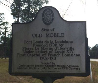
Site of Old Mobile
Old Mobile
Fort Louis de la Louisiane
Founded 1702 by
Pierre Le Moyne d’Iberville
Under orders of Louis XIV
First Capital of French Louisiana
1702-1711
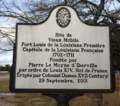
Vieux Mobile
Fort Louis de la Louisiane Premiére
Capitale de la Louisiane Française
1702-1711
Fondée par
Pierre Le Moyne d’Iberville
par ordre de Louis XIV, Roi de France
Érigée par Colonial Dames XVII Century
29 Septembre, 2001
Erected 2001 by Christopher Branch Chapter, Mobile, Alabama, National Society Colonial Dames XVII Century.
Topics and series. This historical marker is listed in these topic lists: Colonial Era • Forts and Castles • Settlements & Settlers. In addition, it is included in the The Colonial Dames XVII Century, National Society series list. A significant historical year for this entry is 1702.
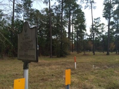
Location. 30° 57.446′ N, 88° 1.609′ W. Marker is near Creola, Alabama, in Mobile County. Marker is on U.S. 43, ¼ mile north of Richie Road, on the right when traveling north. Touch for map. Marker is at or near this postal address: 12950 US Hwy 43, Axis AL 36505, United States of America. Touch for directions.
Other nearby markers. At least 8 other markers are within 9 miles of this marker, measured as the crow flies. Kirk House (approx. 1.8 miles away); Ellicott's Stone (approx. 2.7 miles away); St. Peter the Apostle Catholic Church (approx. 5.6 miles away); Mount Vernon Historical Museum and Train Depot (approx. 8.9 miles away); Mt. Vernon Federal Highway (approx. 8.9 miles away); Fort Stoddert (approx. 8.9 miles away); Mt. Vernon Arsenal and Barracks/Searcy Hospital (approx. 9 miles away); Mount Vernon Arsenal (approx. 9 miles away).
Credits. This page was last revised on April 11, 2020. It was originally submitted on December 5, 2013, by Mark Hilton of Montgomery, Alabama. This page has been viewed 1,900 times since then and 174 times this year. Photos: 1, 2, 3. submitted on December 5, 2013, by Mark Hilton of Montgomery, Alabama. • Bernard Fisher was the editor who published this page.


