Near Kimball in Stearns County, Minnesota — The American Midwest (Upper Plains)
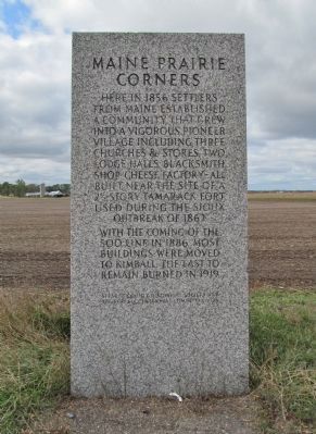
Maine Prairie Corners
With the coming of the Soo Line in 1886, most buildings were moved to Kimball. The last to remain burned in 1919.
the Kimball Centennial Committee 1949
Erected 1949 by the Minnesota Department of Highways, Stearns County Historical Society and the Kimball Centennial Committee. (Marker Number SN-MPR-004.)
Topics. This historical marker is listed in these topic lists: Forts and Castles • Railroads & Streetcars • Settlements & Settlers • Wars, US Indian. A significant historical year for this entry is 1856.
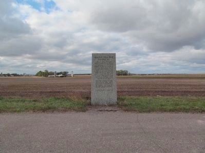
Location. 45° 22.833′ N, 94° 16.041′ W. Marker is near Kimball, Minnesota, in Stearns County. Marker is on State Highway 15 south of County Road 8, on the left when traveling north. Marker is at a paved highway pull-off approximately 5 miles north of Kimball. Touch for map. Marker is in this post office area: Kimball MN 55353, United States of America. Touch for directions.
Other nearby markers. At least 8 other markers are within 11 miles of this marker , measured as the crow flies. The Fair Haven Fort (approx. 4.9 miles away); Luxemburg (approx. 5.2 miles away); Veterans Park (approx. 8.4 miles away); Assumption Chapel (AKA Grasshopper Chapel) (approx. 8.8 miles away); Exploring The Mississippi Headwaters (approx. 9.9 miles away); Schoolhouse (approx. 10.7 miles away); State Farm (approx. 10.7 miles away); Annandale World War I Memorial (approx. 10.7 miles away).
Also see . . . Minnesota Department of Transportation. Historic Roadside Development Structures Inventory. "The nine-foot-tall, 2 1/2 ton granite monument was a gift of the Cold Spring Granite Company. The text was written by Mrs. Clayton Greely of Kimball. Caesar Copeland of the Beim Farm installed the marker's foundation, and the Kimball Centennial Committee provided funding for the foundation and the dedication ceremonies. The marker was dedicated on Thanksgiving Day, 1949. The Kimball American Legion color guard opened the event and Glanville Smith, president of the Stearns County Historical Society, addressed the gathering..." (Submitted on December 14, 2013.)
Additional keywords. Maine Prairie Pioneers Monument
Credits. This page was last revised on June 16, 2016. It was originally submitted on December 14, 2013, by Keith L of Wisconsin Rapids, Wisconsin. This page has been viewed 949 times since then and 77 times this year. Photos: 1, 2. submitted on December 14, 2013, by Keith L of Wisconsin Rapids, Wisconsin.

