Galveston in Galveston County, Texas — The American South (West South Central)
Galveston Island
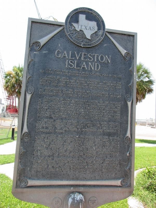
Few spots have played a more exciting role in the life of Texas than Galveston Island.
Cabeza de Vaca, the Spanish explorer, wrote of the cannibalistic Karankawa Indians when he was shipwrecked here in 1528. The island became headquarters for Jean Lafitte and other adventurers between 1815 and 1821.
Importance of the harbor was recognized as early as 1825 when Stephen F. Austin petitioned the Mexican government to establish a port.
Galveston became temporary capital of the Republic in April, 1836, when President David G. Burnet fled here at the approach of Mexican Gen. Santa Anna. After the revolution Galveston's place as first city of the Republic became fixed. Immigrants poured through the port. The Texas Navy was berthed here. With statehood in 1845 came continued growth; Texas first telegraph (1854), first national bank (1865), first electric lights (1888).
Capture and recapture of Galveston were principal Texas engagements of the Civil War. The port fell to blockading Union troops Oct. 4, 1862. It was retaken Jan. 1, 1863, by Gen. John B. Magruder and remained in Confederate hands.
Galveston was again on the nation's lips Sept. 8, 1900, when a hurricane packing winds of 120 mph swept a vast tidal wave across the island, killing 5,000. No other American disaster has taken a greater toll. The storm had two immediate results -- construction of a protective seawall 17 feet high and 7½ miles long and creation of a commission form of city government, an innovation that spread to other American municipalities.
The port remains one of the state's most important, handling more sulphur than any in the world. Important to sightseers and motorists are the toll-free ferries operated by the Texas Highway Department across the 2½-mile strait between the island and Port Bolivar.
Erected 1967 by Texas Highway Department. (Marker Number 7470.)
Topics. This historical marker is listed in these topic lists: Disasters • Exploration • Settlements & Settlers • Waterways & Vessels. A significant historical month for this entry is April 1836.
Location. 29° 19.652′ N, 94° 46.359′ W. Marker is in Galveston, Texas, in Galveston County. Marker can be reached from Ferry Road (State Highway 87) 0.2 miles north of Avalon Way. Touch for map. Marker is in this post office area: Galveston TX 77550, United States of America. Touch for directions.
Other nearby markers. At least 8 other markers are within 2 miles of this marker, measured as the crow flies. U.S.S. Seawolf Memorial (approx. 0.6 miles away); Galveston Quarantine Stations (approx. 0.7 miles away); Galveston: Gateway to Texas (approx. 0.7 miles away); Galveston, C. S. A. (approx. 0.7 miles away); SS Selma (approx. 0.7 miles away); Galveston Medical College (approx. 1.2 miles away); "Old Red" (approx. 1.2 miles away); St. Mary's Hospital (approx. 1.3 miles away). Touch for a list and map of all markers in Galveston.
Also see . . .
1. The Official Galveston Website. (Submitted on December 16, 2013, by Jim Evans of Houston, Texas.)
2. Wikipedia on Galvestion. (Submitted on December 16, 2013, by Jim Evans of Houston, Texas.)
3. Texas Parks and Wildlife Page on Galveston. (Submitted on December 16, 2013, by Jim Evans of Houston, Texas.)
4. Moody Gardens Entertainment Park. (Submitted on December 16, 2013, by Jim Evans of Houston, Texas.)
5. In the Handbook of Texas. (Submitted on December 16, 2013, by Jim Evans of Houston, Texas.)
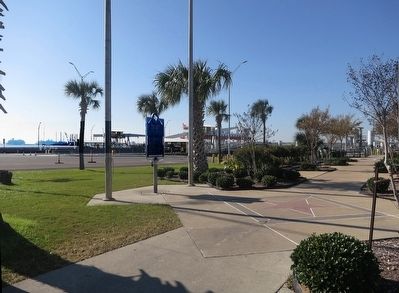
Photographed By Jim Evans, December 15, 2013
3. Galveston Island Marker & Boliver Ferry
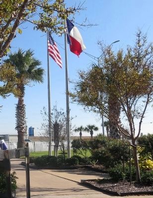
It's hard to see but in the middle of the picture behind the palm is the Galveston-end dock for the Bolivar Ferry. This is a free ferry that goes back and forth to Bolivar Peninsula. Far off on the left of the picture are two cruise ships. Many cruises run out of Galveston Island.
Credits. This page was last revised on August 30, 2023. It was originally submitted on December 16, 2013, by Jim Evans of Houston, Texas. This page has been viewed 1,106 times since then and 26 times this year. Photos: 1. submitted on August 29, 2023, by Jeff Leichsenring of Garland, Texas. 2, 3, 4, 5. submitted on December 16, 2013, by Jim Evans of Houston, Texas. • Bernard Fisher was the editor who published this page.
