Dunseverick in Causeway Coast and Glens, Northern Ireland, United Kingdom — Northwestern Europe (the British Isles)
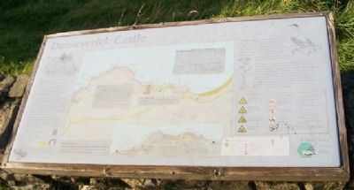
Dunseverick Castle
Causeway Coastal Route
Photographed by William Fischer, Jr., September 16, 2012
1. Dunseverick Castle Marker
Dunseverick Castle and its rocky peninsula were given to the National Trust in 1962 by farmer Jack McCurdy.
The term Dun (fort) indicates a royal site. This was the fort of Sobhairce. It may have been a royal stronghold in the Iron Age (around 500 B.C.) and traditionally was one of the great duns of Ireland.
St. Patrick reputedly visited Dunseverick in the 5th Century. The extensive earthworks on the headland may be the remains of the royal fort from which the Antrim kingdom of Dalriada was ruled in the Early Christian period. It was attacked and captured by Vikings in 871 and later destroyed by them in 926.
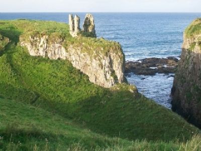
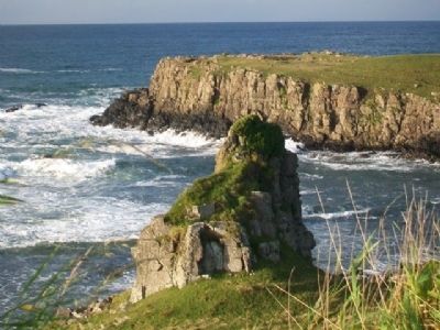
The ruined 16th century stone tower remains from the period of struggles for supremacy between the main families - the MacDonnells, O'Neills, O'Cahans and MacQuillans.
———————
The Eider, a large sea duck, inhabits the bays along this coast all the year round. The male is black and white, the female brown. In summer, the male moults to a similar colour to the female. The female rears her young alone on nearby islands and below isolated headlands. She lines her nest warmly with feathers plucked from her own breast.
this page online
From spring through to autumn, the coarse grasslands of the cliff tops and slopes may be sprinkled with mainly cream canopies of a range of flower species belonging to the family Umbelliferae. The umbel is the name for the clustered arrangement of the flowers Alexanders in April (favouring road verges), Pignut in May, Hogweed in June, Wild Carrot in July, Angelica in August and Yarrow throughout summer to autumn, some remaining in bloom into winter. These flowers are popular with insects, from small flies to orange soldier beetles.
———————
The Causeway Coast Path is managed by the National Trust in partnership with Moyle District Council, Coleraine Borough Council and through the co-operation of local landowners and the Department of Agriculture for Northern Ireland. The Giant's Causeway is owned and managed by the National Trust. The Visitor Centre and car parks are owned and managed by Moyle District Council. THIS PROJECT IS PART FINANCED BY THE EUROPEAN COMMUNITY European Regional Development Fund and the Department of the Environment for Northern Ireland.
Erected by The National Trust,
Photographed by William Fischer, Jr., September 16, 2012
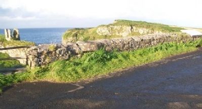
2. Dunseverick Castle and Marker
Topics. This historical marker is listed in these topic lists: Environment • Forts and Castles • Settlements & Settlers. A significant historical year for this entry is 1962.
Location. 55° 14.244′ N, 6° 26.909′ W. Marker is in Dunseverick, Northern Ireland, in Causeway Coast and Glens. It is on Causeway Road (B146), on the left when traveling east. Marker is at a roadside pullout. Touch for map. Marker is at or near this postal address: 182 Causeway Road, Dunseverick, Northern Ireland BT57 8SY, United Kingdom. Touch for directions.

Regionally, this marker is in Causeway Coast & Glens. Globally, it is on the Atlantic Ocean, in the North Atlantic Region, in Europe, on the Island of Ireland, on the Celtic Fringe, in Atlantic Europe, on one of the British Isles, in the Western World, and in the Anglosphere.
Other nearby markers. At least 8 other markers are within 10 kilometers of this marker, measured as the crow flies: Alphabet Angel (approx. 5.8 kilometers away); Giant’s Causeway and Bushmills Railway (approx. 5.9 kilometers away); World Wars Memorial (approx. 5.9 kilometers away); Sgt. Robert Quigg (approx. 5.9 kilometers away); Bushmills History & Heritage (approx. 6 kilometers away); Hamill Terrace (approx. 6.1 kilometers
Photographed by William Fischer, Jr., September 16, 2012
3. Dunseverick Castle Ruins
Also see . . .
1. Dunseverick Castle to the Giant's Causeway Trail. causeway Coast Way website entry (Submitted on December 21, 2013, by William Fischer, Jr. of Reynoldsburg, Ohio.)
2. An Ancient Royal Site – Dunseverick Castle. Castrum to castle website entry (Submitted on April 29, 2025, by Larry Gertner of New York, New York.)
Photographed by William Fischer, Jr., September 16, 2012
4. Dunseverick Castle Round Tower Ruins
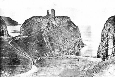
Photographed by Robert French, circa 1900
5. Dunseverick Castle Ruins
Historical photo of Dunseverick Castle, from the Lawrence Collection, National Library of Ireland
Credits. This page was last revised on April 29, 2025. It was originally submitted on December 21, 2013, by William Fischer, Jr. of Reynoldsburg, Ohio. This page has been viewed 1,189 times since then and 50 times this year. Photos: 1, 2, 3, 4. submitted on December 21, 2013, by William Fischer, Jr. of Reynoldsburg, Ohio. 5. submitted on December 21, 2013.
