Anoka in Anoka County, Minnesota — The American Midwest (Upper Plains)
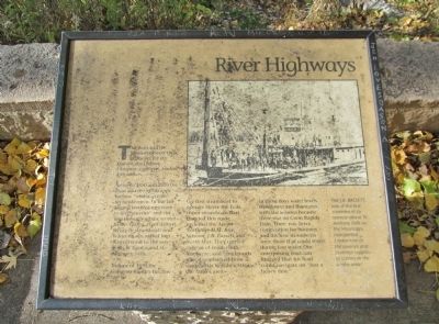
River Highways
The Rum and the Mississippi were river highways for the Dakota, the Ojibwa, European explorers, traders and settlers.
Between 1850 and 1870 the Rum and the Mississippi became "working rivers" for lumbermen. In the fall loggers traveled upstream to the "pineries" and cut logs throughout the winter. In the spring, river drivers living in steamboats and wanningans, rafted logs downstream to the sawmills at Anoka and St. Anthony Falls.
In June of 1850 the Governor Ramsey became the first steamboat to operate above the Falls. Other steamboats that traveled this route included the Anson Northrup, H.M Rice, Samson, J.B. Bassett and North Star. They carried cargoes of food, cloth, hardware, and immigrants who disembarked from steamboats here to settle in the Anoka area.
In those days water levels were lower and fluctuated with the seasons because there was no Coon Rapids Dam. There was fierce competition for business and the best steamboats were those that could travel during low water. One enterprising boatman bragged that his boat could navigate on "Just a heavy dew."
Topics. This historical marker is listed in these topic lists: Industry & Commerce • Waterways & Vessels. A significant historical month for this entry is June 1850.
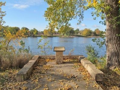
Location. 45° 11.448′ N, 93° 23.509′ W. Marker is in Anoka, Minnesota, in Anoka County. Marker can be reached from South Ferry Road, 0.3 miles east of South Ferry Street (U.S. 169). Marker is in Peninsula Point Park. Touch for map. Marker is at or near this postal address: 1460 South Ferry Parkway, Anoka MN 55303, United States of America. Touch for directions.
Other nearby markers. At least 8 other markers are within walking distance of this marker. Fireman's Grove (about 300 feet away, measured in a direct line); Where Land and Water Meet (about 300 feet away); Bridging the Mississippi (about 300 feet away); Circle of Life (about 300 feet away); Highway of Exploration (about 300 feet away); Logbooms Meet Sawmills (about 300 feet away); Where Cultures Meet (about 400 feet away); Who Lived Here / Neighborhood Names / Building a Community (approx. 0.2 miles away). Touch for a list and map of all markers in Anoka.
More about this marker. photo captions:
• Courtesy of the Anoka County Historical Society.
• The J.B. Bassett, one of the first steamboats to operate above St. Anthony Falls on the Mississippi, transported lumbermen to the pineries and essential supplies to settlers in the Anoka area.
Credits. This page was last revised on October 13, 2020. It was originally submitted on December 25, 2013, by Keith L of Wisconsin Rapids, Wisconsin. This page has been viewed 733 times since then and 13 times this year. Photos: 1, 2, 3. submitted on December 25, 2013, by Keith L of Wisconsin Rapids, Wisconsin.


