Brookfield in Fairfield County, Connecticut — The American Northeast (New England)
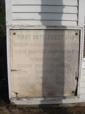
First Settlement 1710
Newbury Parish Incorporated 1754
Town of Brookfield Incorporated 1788
Pioneer Families
Dunning • Peck • Hawley • Smith • Northrop • Ruggles • Dibble • Merwin • Baldwin • Blackmanstarr • Wheeler
Presented By E.A. Rousman 1910
Erected 1910.
Topics. This historical marker is listed in these topic lists: Colonial Era • Settlements & Settlers. A significant historical year for this entry is 1710.
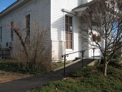
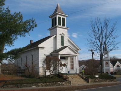
Location. 41° 27.971′ N, 73° 23.271′ W. Marker is in Brookfield, Connecticut, in Fairfield County. Marker is at the intersection of Whisconier Road (Connecticut Route 25) and Obtuse Hill Road (Connecticut Route 133), on the right when traveling north on Whisconier Road. Located on the front of the Brookfield Historical Society building. Touch for map. Marker is at or near this postal address: 165 Whisconier Road, Brookfield CT 06804, United States of America. Touch for directions.
Other nearby markers. At least 8 other markers are within 5 miles of this marker, measured as the crow flies. Brookfield (a few steps from this marker); Brookfield Veterans Monument (approx. ¼ mile away); Space Shuttle Tire (approx. 4.6 miles away); Childhood Home of Capt. William D. Burnham (approx. 4.8 miles away); Bridgewater (approx. 4.8 miles away); Twin Red Oaks (approx. 4.8 miles away); Bridgewater Center (approx. 4.8 miles away); Bridgewater WW I Memorial (approx. 4.9 miles away). Touch for a list and map of all markers in Brookfield.
Also see . . . Brookfield Museum and Historical Society. Society website homepage (Submitted on December 29, 2013, by Michael Herrick of Southbury, Connecticut.)
Credits. This page was last revised on May 12, 2022. It was originally submitted on December 29, 2013, by Michael Herrick of Southbury, Connecticut. This page has been viewed 622 times since then and 18 times this year. Photos: 1, 2, 3. submitted on December 29, 2013, by Michael Herrick of Southbury, Connecticut.


