Lancaster in Garrard County, Kentucky — The American South (East South Central)
Birthplace of Carry A. Nation / Lady with the Hatchet
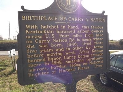
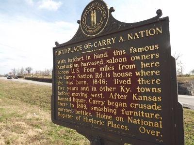
Birthplace of Carry A. Nation
With hatchet in hand, this famous Kentuckian harassed saloon owners across U.S. Four miles from here on Carry Nation Rd. is house where she was born, 1846; lived there five years and in other Ky. towns before moving west. After Kansas banned liquor, Carry began crusade there in 1899, smashing furniture, mirrors, bottles. Home on National Register of Historic Places. Over.
Reverse
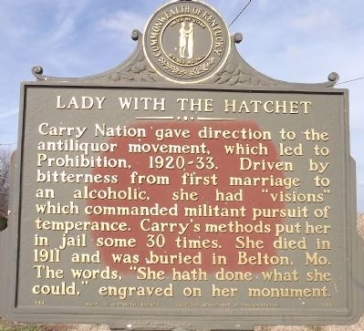
Lady with the Hatchet
Carry Nation gave direction to the antiliquor movement, which led to Prohibition, 1920-33. Driven by bitterness from first marriage to an alcoholic, she had "visions" which commanded militant pursuit of temperance. Carry's methods put her in jail some 30 times. She died in 1911 and was buried in Belton, Mo. The words, "She hath done what she could," engraved on her monument.
Erected 1983 by Kentucky Historical Society & Kentucky Department of Highways. (Marker Number 1733.)
Topics and series. This historical marker is listed in these topic lists: Charity & Public Work • Women. In addition, it is included in the Kentucky Historical Society series list. A significant historical year for this entry is 1846.
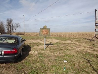
Location. 37° 41.141′ N, 84° 40.72′ W. Marker is in Lancaster, Kentucky, in Garrard County. Marker is at the intersection of Kentucky Route 34 and Fisher Ford Road (County Route 1329), on the right when traveling west on State Route 34. Touch for map. Marker is at or near this postal address: 24 Fisher Ford Road, Lancaster KY 40444, United States of America. Touch for directions.
Other nearby markers. At least 8 other markers are within 6 miles of this marker, measured as the crow flies. Camp Dick Robinson (approx. one mile away); James Thompson, 1750-1825 (approx. 2 miles away); Forks of Dix River Baptist Church (approx. 2.1 miles away); J.S. Wallace House (approx. 4.7 miles away); Fisher's Garrison (approx. 4.9 miles away); Clark's Station (approx. 5.4 miles away); Old Crow Inn / John Crow (approx. 5˝ miles away); John William Bate (approx. 5.6 miles away). Touch for a list and map of all markers in Lancaster.
Also see . . .
1. Who2 Biography - "Carry Nation" ::. (Submitted on December 30, 2013.)
2. Kansapedia: 'Carry Nation' Biography ::. (Submitted on December 30, 2013.)
Credits. This page was last revised on April 24, 2018. It was originally submitted on December 29, 2013, by Ken Smith of Milan, Tennessee. This page has been viewed 724 times since then and 39 times this year. Photos: 1, 2, 3, 4. submitted on December 29, 2013, by Ken Smith of Milan, Tennessee. • Al Wolf was the editor who published this page.


