Near Morton in Redwood County, Minnesota — The American Midwest (Upper Plains)
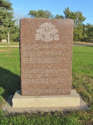
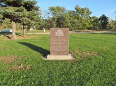
Repatriation Monument
Ta ku wicuonyanpi kin hena, ca hota tawapi kin hena wakan qa tukted wicahapi kin hed maka kin hena nakin wakan.
Tona okioize ed opapi kin hena wicunkisuyapi. Oa maknce unkitawapi kin akand cante wasteya qa wookiye yuha untipi kte.
Unkan waniyetu opawinqe som wikcemna num som zaptan hehand ta ku wicuonyanpi kin hena. Nov. 7, 1987 hehan awicahapi qa ded wicahapi.
"To us the ashes of our ancestors are sacred and their resting place is hallowed ground."
"In memory of those who died so we could live in peace upon our land."
On Nov. 7, 1987 the remains of 31 of our relatives were reburied here after 125 years. They were returned to their final resting place.
This marker was erected and donated in part by the State of Iowa in cooperation with the Lower Sioux Community members.
Erected by the State of Iowa in cooperation with the Lower Sioux Community members.
Topics. This historical marker and monument is listed in this topic list: Native Americans. A significant historical month for this entry is October 1861.
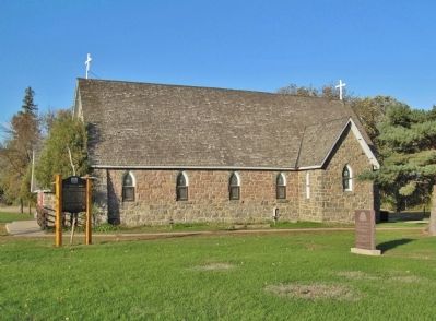
Location. 44° 31.996′ N, 94° 59.721′ W. Marker is near Morton, Minnesota, in Redwood County. Marker can be reached from Reservation Road 101, 0.1 miles east of Reservation Highway 1, on the left when traveling east. Monument is located within the Lower Sioux Indian Community immediately south of St. Cornelia's Church. Touch for map. Marker is at or near this postal address: 38378 Reservation Road 101, Morton MN 56270, United States of America. Touch for directions.
Other nearby markers. At least 8 other markers are within 2 miles of this marker, measured as the crow flies. St. Cornelia's Church (a few steps from this marker); Lower Sioux Veterans Memorial (about 300 feet away, measured in a direct line); Mdewakanton Ehdakupi Wanagi Makoce (about 400 feet away); Robert's Trading Post Site (approx. 1˝ miles away); Forbes' Trading Post Site (approx. 1˝ miles away); Myrick's Trading Post Site (approx. 1.6 miles away); The Remains of Hon. J.W. Lynde (approx. 1.6 miles away); Caught Unaware! (approx. 1.6 miles away). Touch for a list and map of all markers in Morton.
Also see . . . Lower Sioux Indian Community. Community website entry:
History of the Mdewakanton Band of Dakota. In August of 1862, young traditionalists in four bands waged war against the United States following two years of unfulfilled treaty obligations... After defeating the bands, the United States punished the Dakota by removing all Dakota from what is now the State of Minnesota. (Submitted on January 1, 2014.)
Credits. This page was last revised on December 27, 2021. It was originally submitted on January 1, 2014, by Keith L of Wisconsin Rapids, Wisconsin. This page has been viewed 607 times since then and 12 times this year. Photos: 1, 2, 3. submitted on January 1, 2014, by Keith L of Wisconsin Rapids, Wisconsin.


