Danbury in Fairfield County, Connecticut — The American Northeast (New England)
The Settling of Danbury
Danbury, Connecticut
— The Museum in the Streets —
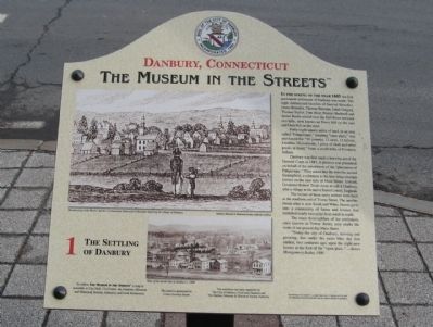
In the spring of the year 1685, the first permanent settlement of Danbury was made. The eight determined families of Samuel Benedict, James Benedict, Thomas Barnum, Judah Gregory, Thomas Taylor, John Hoyt, Francis Bushnell and James Beebe settled near the Still River between two hills, now known as Town Hill on the east and Deer Hill on the west.
Forty-eight square miles of land, in an area called “Pahquioque,” meaning “open plain,” was purchased for “30 pounds, 12 axes, 12 knives, 4 kettles, 10 overcoats, 1 piece of cloth and other goods in hand,” from a small tribe of Potatuck Indians.
Danbury was first made a town by act of the General Court in 1687. A petition was presented on behalf of the inhabitants of the “plantation of Pahquioque.” They asked that the town be named Swampfield, a reference to the low-lying swampy terrain on the east side of Main Street. Instead, Governor Robert Treat chose to call it Danbury after a village in his native Essex County, England.
The homes of these early settlers were built at the southern end of Towne Street. The area between what is now South and White Streets grew into a community of farms and houses that stretched nearly two miles from south to north.
The main thoroughfare of the settlement once known as Towne Street, now marks the route of our present day Main Street.
“Today the city of Danbury, thriving and growing, lies under the same blue sky that smiled, two centuries ago, upon the eight Listed on the eight new homes at the foot of the “open plain.” – James Montgomery Bailey, 1890
Erected by The Museum in the Streets®. (Marker Number 1.)
Topics and series. This historical marker is listed in these topic lists: Colonial Era • Settlements & Settlers. In addition, it is included in the The Museum in the Streets®: Danbury, Connecticut series list. A significant historical year for this entry is 1685.
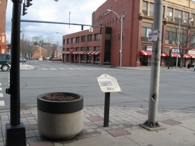
Location. 41° 23.623′ N, 73° 27.104′ W. Marker is in Danbury, Connecticut, in Fairfield County. Marker is at the intersection of Main Street and West Street, on the right when traveling south on Main Street. Touch for map. Marker is at or near this postal address: 186 Main Street, Danbury CT 06810, United States of America. Touch for directions.
Other nearby markers. At least 8 other markers are within walking distance of this marker. To Our Brothers (within shouting distance of this marker); War Memorial (within shouting distance of this marker); Kenosia & Candlewood (within shouting distance of this marker); Old City Center Square (within shouting distance of this marker); Danbury Women of Note (within shouting distance of this marker); Danbury City Hall Wall (within shouting distance of this marker); Sybil Ludington (within shouting distance of this marker); Danbury Firsts (about 300 feet away, measured in a direct line). Touch for a list and map of all markers in Danbury.
Also see . . . Danbury, Connecticut on Wikipedia. (Submitted on January 12, 2014, by Michael Herrick of Southbury, Connecticut.)
Credits. This page was last revised on March 4, 2024. It was originally submitted on January 12, 2014, by Michael Herrick of Southbury, Connecticut. This page has been viewed 945 times since then and 81 times this year. Photos: 1, 2. submitted on January 12, 2014, by Michael Herrick of Southbury, Connecticut.

