Marker Logo HMdb.org THE HISTORICAL
MARKER DATABASE
“Bite-Size Bits of Local, National, and Global History”
Near Sacred Heart in Renville County, Minnesota — The American Midwest (Upper Plains)
 

The Kittelsland Water Wheel


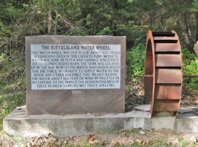
The Kittelsland Water Wheel Marker image. Click for full size.
Photographed By K. Linzmeier, September 25, 2013
1. The Kittelsland Water Wheel Marker
Inscription. This water wheel was put to use about 100 years ago, (around 1900) in this creek to pump water to a storage tank in Peter and Gunhild (Enestvedt) Kittelsland's round barn. The tank was located up in the hay mow so the water had enough height for the force of gravity to supply water to the house and other buildings. This meant raising the water about 100 feet or more with little or no expense to the family. The resourcefulness of these pioneer families was truly amazing.
 
Erected 2004.
 
Topics. This historical marker is listed in these topic lists: Industry & CommerceWaterways & Vessels. A significant historical year for this entry is 2004.
 
Location. 44° 41.088′ N, 95° 17.984′ W. Marker is near Sacred Heart, Minnesota, in Renville County. Marker is on County Highway 12, 0.2 miles south of 145th Street (County Road 15), on the left when traveling south. Touch for map. Marker is in this post office area: Sacred Heart MN 56285, United States of America. Touch for directions.
 
Other nearby markers. At least 8 other markers are within 4 miles of this marker, measured as the crow flies. The Enestvedt Marker (here, next to this marker); A Family's Proud Heritage (about 700 feet away, measured in a direct line); A New Life with Family and Friends (approx. one mile away); Farther and Gay Castle (approx. 1.4 miles away); The Joseph R. Brown House
Paid Advertisement
Click on the ad for more information.
Please report objectionable advertising to the Editor.
Click or scan to see
this page online
(approx. 1.4 miles away); Boiling Spring (approx. 2.9 miles away); Vicksburg Cemetery (approx. 3.8 miles away); Taoyateduta Leads His People in War (approx. 4 miles away). Touch for a list and map of all markers in Sacred Heart.
 
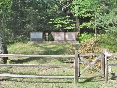
The Kittelsland Water Wheel and Marker image. Click for full size.
Photographed By K. Linzmeier, September 25, 2013
2. The Kittelsland Water Wheel and Marker
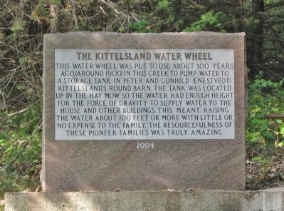
The Kittelsland Water Wheel and Marker image. Click for full size.
Photographed By K. Linzmeier, September 25, 2013
3. The Kittelsland Water Wheel and Marker
The Enestvedt Marker is to the right.
 
 
Credits. This page was last revised on December 15, 2020. It was originally submitted on January 14, 2014, by Keith L of Wisconsin Rapids, Wisconsin. This page has been viewed 749 times since then and 14 times this year. Photos:   1, 2, 3. submitted on January 14, 2014, by Keith L of Wisconsin Rapids, Wisconsin.
Share this page.  
Share on Tumblr
m=71281

CeraNet Cloud Computing sponsors the Historical Marker Database.
This website earns income from purchases you make after using our links to Amazon.com. We appreciate your support.
Paid Advertisements
Mar. 19, 2024