Produce and Waterfront in Oakland in Alameda County, California — The American West (Pacific Coastal)
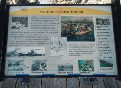
Evolution of a Marine Terminal
Photographed by Barry Swackhamer, January 9, 2014
1. Evolution of a Marine Terminal Marker
Captions: Bird’s-eye view 1893 (top, right); Howard Terminal – 1900 (center, right); Quay Wall, Municipal Dock No. 1 (bottom, right (l)); Grove Street Terminal – 1928 (bottom, right (r)); Weatherproof containers don’t need protection from the elements. Modern marine terminals look like big parking lots. (top, center); Charles P. Howard Terminal – 1982 (bottom, center (l)); Howard Terminal – 1997 (bottom, center (r)); Quay wall under construction circa 1913. (sidebar, top); A remnant of the original quay wall can be seen west of the foot of Clay Street. (sidebar, bottom).
Containerization, introduced in Oakland in 1962, brought speed and standardization units to cargo handling. The Port bought the private
this page online
sidebar on right
Constructed between 1910 and 1914, the quay wall was a long bulkhead that measured forty feet from top to bottom, and tapered from twenty-two feet wide at its base to eighteen inches at the top. Because the quay wall was built inland from the shore, tons of soil were removed on the harbor side. Dredging created a berthing basin with a depth of 27 feet at low tide. Sediment placed on the shore side of the wall became a 150-foot-wide wharf.
Erected by Port of Oakland.
Topics. This historical marker is listed in these topic lists: Industry & Commerce • Waterways & Vessels. A significant historical year for this entry is 1900.
Location. 37° 47.705′ N, 122° 16.786′ W. Marker is in Oakland, California, in Alameda County. It is in Produce and Waterfront. It can be reached from Clay Street near Water Street. Touch for map. Marker is in this post office area: Oakland CA 94607, United States of America. Touch for directions.

Regionally, this marker is in the San Francisco Bay
Photographed by Barry Swackhamer, January 9, 2014
2. Evolution of a Marine Terminal Marker
This marker is closest to the camera.
Other nearby markers. At least 8 other markers are within walking distance of this marker: Charles P. Howard Terminal (here, next to this marker); History of the Transbay Ferry (a few steps from this marker); USS Potomac (within shouting distance of this marker); The Port of Oakland (about 300 feet away, measured in a direct line); Jack London (about 700 feet away); Oakland's First Wharf (about 700 feet away); Live Oak Lodge U.D (about 700 feet away); Origins of Oakland (about 700 feet away). Touch for a list and map of all markers in Oakland.
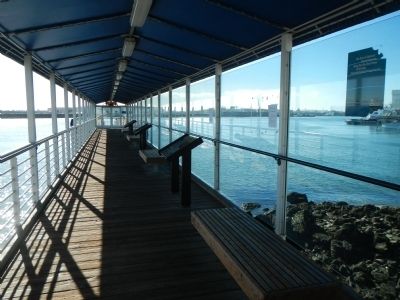
More about this marker. This marker is located at the Oakland Ferry Terminal in Jack London Square.
Also see . . . About the Port: History - Port of Oakland. Here the normally sedate Port Commissioner George Pardee, then mayor of Oakland, personally kicked down a fence that the Southern Pacific railroad, which once claimed exclusive ownership of Oakland's waterfront, had erected across Broadway in 1893. Finally, in 1906, the California Supreme Court ended the lengthy disputes by ruling in the city's favor.
Photographed by Barry Swackhamer, January 9, 2014
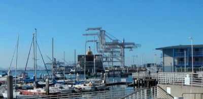
3. Port of Oakland Marine Terminal in the background
Credits. This page was last revised on February 7, 2023. It was originally submitted on January 18, 2014, by Barry Swackhamer of Brentwood, California. This page has been viewed 826 times since then and 54 times this year. Photos: 1, 2, 3. submitted on January 18, 2014, by Barry Swackhamer of Brentwood, California. • Bill Pfingsten was the editor who published this page.
