Danbury in Western Region, Connecticut — The American Northeast (New England)
Country Lanes & City Streets
Danbury, Connecticut
| — | The Museum in the Streets® | — |
Photographed by Michael Herrick, December 30, 2013
1. Country Lanes & City Streets Marker
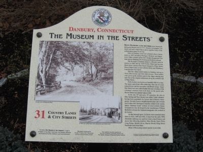
Many Danbury land records were destroyed during the British raid of 1777. Historic newspapers, old deeds and early maps help us piece together some of the earliest place names of our city.
Parts of Danbury were lost to Bethel when it broke away in 1855 including Pinchgut, Wolfpits, and Puppytown. Other colorful names have simply disappeared over time such as Mashing Tub Swamp and Stubble-lot Road.
The Borough of Danbury began to officially name its streets in 1846 and by 1878 Towne Street had become Main Street. Barren Plain Road changed to White Street, Horse Island Lane is now Liberty Street and Whittlesey Lane became New Street.
The two oldest street names in Danbury belong to Town Hill Avenue and Deer Hill Avenue. These names were given in the earliest years to the ridges running east and west of the original settlements along the southern end of Main Street.
Park Avenue was known as Squabble Hill for a time. The name came from a Revolutionary War tale of a man named Porter and his encounter with British troops. Upper Elm Street was once called Rabbit Hill due to the hordes of the cottontail creatures
this page online
In the late 18th and early 19th centuries, the area of Elm, Spring and New Streets was called ‘Little Lebanon’ having been populated by Syrian and Lebanese immigrants. Slovaks lived in neighborhoods near Lake Avenue and Golden Hill. Portuguese families settled in the mainly Italian ‘Barbary Coast’ section of lower Liberty Street. Germantown was developed by hat manufacturer William Beckerle to house the German immigrants who worked in his factory.
As the borough grew, its limits were extended three times in 1823, 1846 and 1862. A map from the early 1890s illustrates outlying one and two room school houses and shows the following districts: Miry Brook, Starrs Plain, Long Ridge, Middle River, Beaver Brook, King Street, Pembroke and Great Plain.
Many of these place names remain in use today.
Erected by The Museum in the Streets®. (Marker Number 31.)
Topics and series. This historical marker is listed in these topic lists: Roads & Vehicles • Settlements & Settlers. In addition, it is included in the The Museum in the Streets: Danbury, Connecticut
Photographed by Michael Herrick, December 30, 2013
2. Country Lanes & City Streets Marker
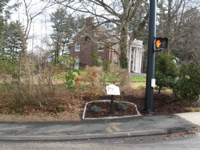
Location. 41° 23.359′ N, 73° 27.125′ W. Marker is in Danbury in Western Region, Connecticut. It is at the intersection of Wooster Street and Deer Hill Avenue, on the right when traveling east on Wooster Street. Touch for map. Marker is in this post office area: Danbury CT 06810, United States of America. Touch for directions.

Regionally, this marker is on the Connecticut Shoreline and in Greater Bridgeport. It is also in the American Northeast and in New England. Globally, it is in North America, the Western Hemisphere, the Western World, and the Anglosphere. Historically, it finds itself in what was once Fairfield County and also one of the original Thirteen Colonies.
Other nearby markers. At least 8 other markers are within walking distance of this marker: Inventions & Innovations (about 300 feet away, measured in a direct line); Industrial Strength Danbury (about 500 feet away); Farming & Agriculture (about 600 feet away); Oldest Cemetery (approx. 0.2 miles away); 19th & 20th Century Immigrants (approx. 0.2 miles away); Diversity in Danbury (approx. 0.2 miles away); Early Arrivals (approx. 0.2 miles away); The Circus Comes to Town (approx. 0.2 miles away). Touch for a list and map of all markers in Danbury.
Credits. This page was last revised on May 19, 2026. It was originally submitted on January 19, 2014, by Michael Herrick of Southbury, Connecticut. This page has been viewed 1,463 times since then and 73 times this year. Photos: 1, 2. submitted on January 19, 2014, by Michael Herrick of Southbury, Connecticut.
