Near Bliss in Gooding County, Idaho — The American West (Mountains)
Formation of Malad Gorge
Photographed by Duane Hall, September 15, 2010
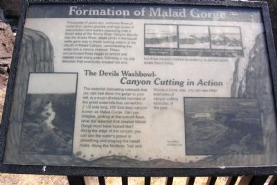
1. Formation of Malad Gorge Marker
The Devil's Washbowl - Canyon Cutting in Action
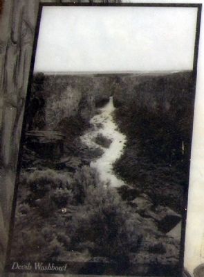
The waterfall (retreating cataract) that you can see down the gorge to your left, is a much diminished remnant of the great waterfalls that carved the 2 1/2 mile long, 250 foot deep canyon known as Malad Gorge. Can you imagine, looking at the current flows, what the waterfall that created Malad Gorge must have looked like? Along the edge of the canyon, you can see the water's power in smoothing and shaping the basalt rocks. Along the Northrim Trail and Woody's Cove area, you can see other examples of canyon cutting episodes of the past.
Topics.
this page online
Location. 42° 52.046′ N, 114° 51.488′ W. Marker is near Bliss, Idaho, in Gooding County. It can be reached from Ritchie Road 0.4 miles north of County Road E2350S. Marker is located in the Malad Gorge Unit of Thousand Springs State Park. Above directions are to the entrance to the park. Touch for map. Marker is in this post office area: Bliss ID 83314, United States of America. Touch for directions.

Regionally, this marker is in Magic Valley. It is also in the American Mountain West. Globally, it is in North America, the Western Hemisphere, the Western World, and the Anglosphere.
Other nearby markers. At least 8 other markers are within 8 miles of this marker, measured as the crow flies: The Malad Springs (here, next to this marker); Woody's Cove / The Hagerman Valley (approx. 1½ miles away); History of the Malad River (approx. 2 miles away); Fossil Beds (approx. 3.1 miles away); Hagerman Sheep Monument (approx. 3.7 miles away); Bliss Homestead (approx. 5½ miles away); Where are the Fossils? (approx. 7.9 miles
Photographed by Duane Hall, September 15, 2010
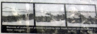
2. Masses of water and pressure cutting into weak basalt joints formed deep canyons
More about this marker. The marker is located at the end of Gorge Overlook Trail, a 1/3 mile walk from the parking lot for the Devil's Washbowl (Stop 1 on the park road tour). The trail crosses over the gorge by pedestrian bridge and follows the north rim of the gorge.
Photographed by Duane Hall, September 15, 2010
3. Devil's Washbowl
Photographed by Duane Hall, September 15, 2010
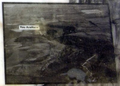
4. Aerial Photo of Malad Gorge
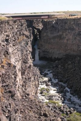
Photographed by Duane Hall, September 15, 2010
5. Devil's Washbowl
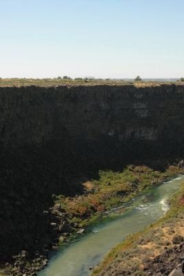
Photographed by Duane Hall, September 15, 2010
6. Malad Gorge
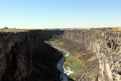
Photographed by Duane Hall, September 15, 2010
7. View to west from Gorge Overlook Trail bridge
Credits. This page was last revised on December 16, 2020. It was originally submitted on February 1, 2014, by Duane Hall of Abilene, Texas. This page has been viewed 1,587 times since then and 78 times this year. Photos: 1, 2, 3, 4, 5, 6, 7. submitted on February 1, 2014, by Duane Hall of Abilene, Texas.
Editor’s want-list for this marker. Photo of wide-view of marker and surroundings. • Can you help?
