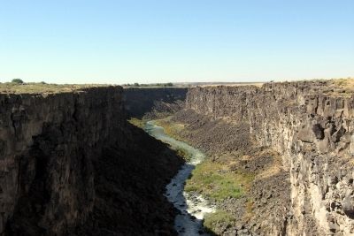
Near Bliss in Gooding County, Idaho — The American West (Mountains)
The Malad Springs
One of the Largest in the Country
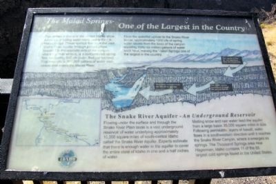
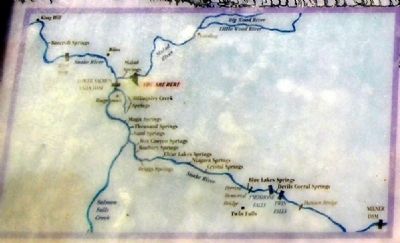
From the waterfall upriver to the Snake River below, approximately 1200 cfs of spring water issues form the base of the canyon equaling thirty-six million gallons of water each hour, making the Malad Springs one of the largest in the country.
The Snake River Aquifer - An Underground Reservoir
Flowing under the surface and through the Snake River Plain lavas is a vast underground reservoir of water underlying approximately 10,000 square miles of south-central Idaho called the Snake River Aquifer. Experts estimate that there is enough water in the aquifer to cover the entire state of Idaho in one and a half inches of water.
Melting snow and rain water feed the aquifer from a large basin 35,000 square miles in size. Following permeable layers of basalt, water flows in a southwestern direction until it reaches the Snake River Canyon, where it emerges as springs. The Thousand Springs area near Hagerman, Idaho contains 11 of the 65 largest cold springs found in the United States.
Topics. This historical marker is listed in this topic list: Natural Features.
Location. 42° 52.046′ N, 114° 51.49′ W. Marker is near Bliss, Idaho, in Gooding County. Marker can be reached from Ritchie Road, 0.4 miles north of County Road E2350S. Marker is located in the Malad Gorge Unit of Thousand Springs State Park. Above directions are to the entrance of the park. Touch for map. Marker is in this post office area: Bliss ID 83314, United States of America. Touch for directions.
Other nearby markers. At least 8 other markers are within 8 miles of this marker, measured as the crow flies. Formation of Malad Gorge (here, next to this marker); Woody's Cove / The Hagerman Valley (approx. 1˝ miles away); History of the Malad River (approx. 2 miles away); Fossil Beds (approx. 3.1 miles away); Hagerman Sheep Monument (approx. 3.7 miles away); Bliss Homestead (approx. 5˝ miles away); Where are the Fossils? (approx. 7.9 miles away); "The People" (approx. 7.9 miles away). Touch for a list and map of all markers in Bliss.
More about this marker. The marker is located at the end of Gorge Overlook Trail, a 1/3 mile walk from the parking lot for the Devil's Washbowl (Stop 1 on the park road tour). The trail crosses over the gorge by pedestrian bridge and follows the north
rim of the gorge.
Credits. This page was last revised on December 16, 2020. It was originally submitted on February 1, 2014, by Duane Hall of Abilene, Texas. This page has been viewed 766 times since then and 31 times this year. Photos: 1, 2, 3, 4, 5. submitted on February 1, 2014, by Duane Hall of Abilene, Texas.
Editor’s want-list for this marker. Photo of wide-view of marker and surroundings. • Can you help?
