Shorewood in Hennepin County, Minnesota — The American Midwest (Upper Plains)
Christmas Lake
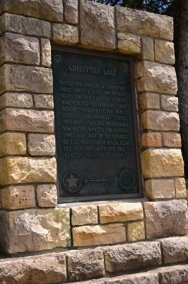
Photographed by Martha Decker, May 31, 2010
1. Christmas Lake Marker
Erected 1941 by Minnesota Historical Society/Minnesota Dept. of Highways. (Marker Number HE-SHC-022.)
Topics and series. This historical marker is listed in these topic lists: Government & Politics • Natural Features • Settlements & Settlers. In addition, it is included in the Minnesota Historical Society series list. A significant historical year for this entry is 1852.
Location. 44° 54.372′ N, 93° 32.232′ W. Marker is in Shorewood, Minnesota, in Hennepin County. It is on State Highway 7, on the right when traveling east. The marker and remains of the southern part of the historic wayside can no longer be accessed directly from MN Highway 7. If you turn south at the Old Market Road stoplight, the area can be accessed via Broms Blvd/Radisson Rd. Touch for map. Marker is in this post office area: Excelsior MN 55331, United States of America. Touch for directions.

Regionally, this marker is in the Twin Cities Metropolitan Area. It is also in the American Midwest, in the Corn Belt, and in the Great River Road Region. Globally, it is in North America, the Western Hemisphere, the Western World, and the Anglosphere. Historically, it finds itself in what was once Rupert’s Land, the territory of the Mississippian Culture, and the Louisiana Purchase.
Other nearby markers. At least 8 other markers are within 2 miles of this marker, measured as the crow flies: Soldiers Memorial (approx. one mile away); In Honor of All Who Served and Those Who Died
this page online
More about this marker. The marker is part of a once grand NYA-built roadside parking area along what is now MN Highway 7. According to the Minnesota highway department's Roadside Development Division's annual report for 1938: "The construction of this development was begun in the spring of 1937 and presents a complete roadside parking area and picnic grounds which includes council ring, fireplaces, picnic tables, athletic field and shelter house, together with an historic marker."
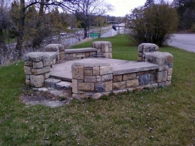
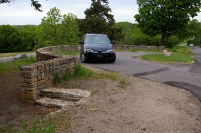
The rustic depression-era council ring, well enclosure, crumbled fireplace, and historical marker still remain on the south side of Minnesota Highway 7. On the north side of the highway (accessible via Excelsior Blvd.), there are also remains of parts the park, mainly the overlook wall.
A "Lake Minnetonka Region" geological marker, erected in
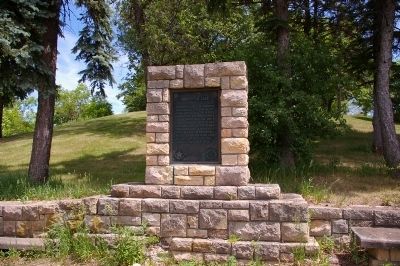
Photographed by Martha Decker, May 31, 2010
2. Christmas Lake Marker
Also see . . .
1. MNDOT's Historic Roadside Development Structures Inventory Sheet. (Submitted on June 14, 2010, by Martha Decker of Shakopee, Minnesota.)
2. Photo of the Missing Geological Marker. (Submitted on June 14, 2010, by Martha Decker of Shakopee, Minnesota.)
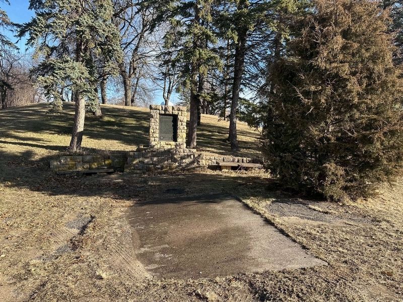
Photographed by Josh Taylor, December 7, 2024
3. Christmas Lake Marker
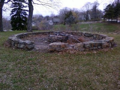
Photographed by Martha Decker, April 30, 2009
4. Council Ring
Depression-era Council Ring at the Christmas Lake Roadside Parking Area. In the background across the highway, you can see the retaining wall that was also part of this Roadside Parking Area.
Photographed by Martha Decker, April 30, 2009
5. Well Enclosure
Rustic NYA-built well enclosure at the Christmas Lake Roadside Parking Area
Photographed by Martha Decker, May 29, 2009
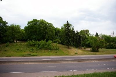
6. Christmas Lake Overlook
Across Minn Hwy 7 from the historical marker on Excelsior Blvd, there is a pullout and retaining wall that was also part of the Christmas Lake Roadside Parking Area.
Photographed by Martha Decker, May 29, 2009
7. View from the Overlook
View of the Christmas Lake RPA Council Ring and Historical Marker from the pullout on the north side of Minn Hwy 7. Council Ring can be seen on the hill towards the left, marker is down the hill towards the right.
Photographed by Josh Taylor, December 7, 2024
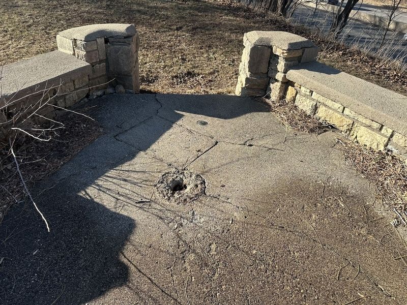
8. Christmas Lake Marker
Possible site of former pump in the middle of the well house. Survey marker can be seen toward the entrance.
Credits. This page was last revised on January 10, 2025. It was originally submitted on June 14, 2010, by Martha Decker of Shakopee, Minnesota. This page has been viewed 3,393 times since then and 76 times this year. Last updated on February 3, 2014, by Martha Decker of Shakopee, Minnesota. Photos: 1, 2. submitted on June 14, 2010, by Martha Decker of Shakopee, Minnesota. 3. submitted on January 4, 2025, by Josh Taylor of Shorewood, Minnesota. 4, 5, 6, 7. submitted on June 14, 2010, by Martha Decker of Shakopee, Minnesota. 8. submitted on January 5, 2025, by Josh Taylor of Shorewood, Minnesota. • Bill Pfingsten was the editor who published this page.
