Near Bliss in Gooding County, Idaho — The American West (Mountains)
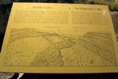
Woody's Cove / The Hagerman Valley
Woody's Cove
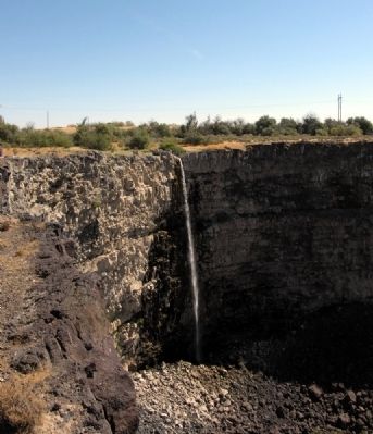
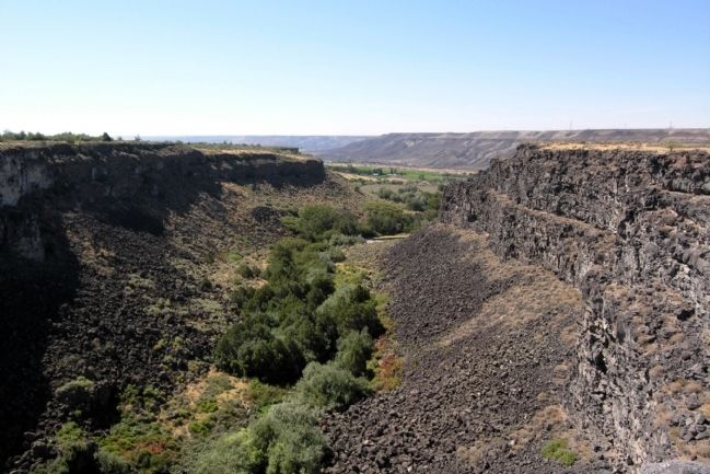
This deep, basalt canyon was formed similar to Malad Gorge – by a retreating cataract, a huge waterfall. About four million years ago, local volcanoes spewed enormous amounts of lava over the area. Then, about one million years ago, runoff from rain and melt water from a nearby glacier flowed over the area. Following zones of weakness in the fractured volcanic rock, the forceful water formed this canyon. The great Bonneville Flood of 15,000 years ago and other major floods also contributed to the formation of canyons such as this along the Snake River.
The Hagerman Valley
Spreading below the steep canyon walls of Malad Gorge State Park along the Snake River lies the beautiful Hagerman Valley. Approximately 20 miles long and from 1/4 to 4 miles wide, the valley features outstanding free flowing springs from the Snake River Aquifer. With mild winters and clean, abundant water, the Hagerman Valley is home to many fish hatcheries and commercial trout farms.
Topics. This historical marker is listed in this topic list: Natural Features.
Location. 42° 51.273′ N, 114° 52.866′ W. Marker is near Bliss, Idaho, in Gooding County. Marker can be reached from Ritchie Road, 0.4 miles north of County Road E2350S. Marker is located in the Malad Gorge Unit of Thousand Springs State Park. Above directions are to the entrance of the park. Marker is located at Stop 6 on the park tour road. Touch for map. Marker is in this post office area: Bliss ID 83314, United States of America. Touch for directions.
Other nearby markers. At least 8 other markers are within 7 miles of this marker, measured as the crow flies. History of the Malad River (approx. 1.1 miles away); The Malad Springs (approx. 1˝ miles away); Formation of Malad Gorge (approx. 1˝ miles away); Hagerman Sheep Monument (approx. 2.4 miles away); Fossil Beds (approx. 2.8 miles away); Bliss Homestead (approx. 5.2 miles away); Where are the Fossils? (approx. 6.6 miles away); "The People" (approx. 6.7 miles away). Touch for a list and map of all markers in Bliss.
Credits. This page was last revised on December 14, 2020. It was originally submitted on February 4, 2014, by Duane Hall of Abilene, Texas. This page has been viewed 672 times since then and 45 times this year. Photos: 1, 2, 3. submitted on February 4, 2014, by Duane Hall of Abilene, Texas.
Editor’s want-list for this marker. Photo of wide-view of marker and surroundings. • Can you help?


