Near Arco in Butte County, Idaho — The American West (Mountains)
A Plain of Volcanoes
Photographed by Duane Hall, September 17, 2010
1. A Plain of Volcanoes Marker
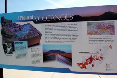
In the past 17 million years , there have been about a dozen catastrophic eruptions releasing huge volumes of rhyolitic magma and ash. Between these super-eruptions were long periods when more fluid basaltic lava flowed from more than 8,000 shield volcanoes and numerous lave cones. Remnants of these dot the Eastern Snake River Plain today. Layer upon layer of basalt flows extend 3,000 - 6,000 feet (1,000 - 2,000 m) below the surface, completely covering the rhyolite “basement.”
(Left Graphic Description)
Sinking Rivers And A Flowing Aquifer
Streams that flow here are indirect tributaries to the Snake River. The aptly named Lost River flows to an area north of here known as “the sinks” where it soaks
this page online
(Middle Graphic Description)
Big Southern Butte
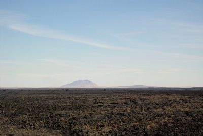
Big Southern Butte, rising 2,500 feet (760 m) above the Eastern Snake River Plain, is a prominent reminder of the region’s volcanism. About 300,000 years ago, the butte intruded through surrounding layers of basalt, rising to an elevation of 7,560 feet (2,300 m). It is one of the largest composite rhyolite domes in the world.
(Right Graphic Description)
Ancient calderas are evidence of the North American Continent’s movement over the Yellowstone hotspot.
When Yellowstone Caldera erupted 640,000 years ago, it released about 240 cubic miles (1,000 km 3) of material, covering half of North America in 6 feet (2 m) of debris.
Topics. This historical marker is listed in this topic list: Natural Features.
Location. 43° 32.911′ N, 113° 0.548′ W. Marker
Photographed by Duane Hall, September 17, 2010
2. Big Southern Butte

Regionally, this marker is in Central Idaho — Sawtooth Range and in Eastern Idaho and the Yellowstone Fringe. It is also in the American Mountain West. Globally, it is in North America, the Rocky Mountains, the Western Hemisphere, the Western World, and the Anglosphere.
Other nearby markers. At least 5 other markers are within 3 miles of this marker, measured as the crow flies: Prehistory and Recent History (here, next to this marker); Lost River (about 300 feet away, measured in a direct line); Nuclear Reactors (about 300 feet away); Oliver Three Disc Gang Plow (approx. 2.6 miles away); EBR-I (approx. 2.6 miles away).
Credits. This page was last revised on June 16, 2016. It was originally submitted on February 5, 2014, by Duane Hall of Abilene, Texas. This page has been viewed 1,088 times since then and 35 times this year. Photos: 1, 2. submitted on February 5, 2014, by Duane Hall of Abilene, Texas.
Editor’s want-list for this marker. Photo of wide-view of marker and surroundings. • Can you help?
