Orange Beach in Baldwin County, Alabama — The American South (East South Central)
Orange Beach Community Cemetery
“Bear Point Cemetery”
| — | Baldwin County | — |
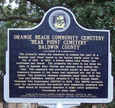
Photographed by David J Gaines, February 6, 2014
1. Orange Beach Community Cemetery Marker, front
(front)
The property where the cemetery is located was part of a Spanish Land Grant issued to the Suarez family prior to the War of 1812. In 1925, a United States Land Patent was confirmed and issued. The property has been in use since the days of Spanish West Florida and perhaps even before this time. The cemetery was previously known as Bear Point Cemetery because of the bears that inhabited this end of the island. The property changed ownership man times until the Low and McKibbon families donated it to the Orange Beach Volunteer Fire Department (OBVFD) in 1979. The OBVFD currently owns the approximately one-quarter acre community cemetery and their Board of Directors operates it under strict guidelines.
this page online
Erected 2011 by Orange Beach Volunteer Fire Department Board.
Topics. This historical marker is listed in these topic lists: Cemeteries & Burial Sites • Settlements & Settlers. A significant historical year for this entry is 1812.
Location. 30° 18.127′ N, 87° 31.427′ W. Marker is in Orange Beach, Alabama, in Baldwin County. It is at the intersection of Canal Road (Alabama Route 180) and Pensacola Avenue, on the right when traveling east on Canal Road. Touch for map. Marker is in this post office area: Orange Beach AL 36561, United States of America. Touch for directions.

Regionally,
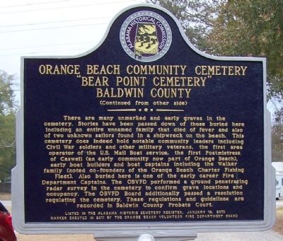
Photographed by David J Gaines, February 6, 2014
2. Orange Beach Community Cemetery Marker, back
Other nearby markers. At least 8 other markers are within 5 miles of this marker, measured as the crow flies: Tampary (approx. 1½ miles away in Florida); Josephine (approx. 1.9 miles away); Perdido Pass (approx. 2½ miles away); Bay Circle (approx. 3 miles away); Orange Beach, Alabama (approx. 3.2 miles away); Orange Beach Municipal Complex (approx. 3.7 miles away); Hugh S. Branyon Backcountry Trail System (approx. 3.7 miles away); Daphne United Methodist Church (approx. 4.7 miles away). Touch for a list and map of all markers in Orange Beach.
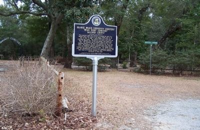
Photographed by David J Gaines, February 6, 2014
3. Orange Beach Community Cemetery Marker
Credits. This page was last revised on June 16, 2016. It was originally submitted on February 6, 2014, by David J Gaines of Pinson, Alabama. This page has been viewed 2,919 times since then and 160 times this year. Photos: 1, 2, 3. submitted on February 6, 2014, by David J Gaines of Pinson, Alabama. • Bernard Fisher was the editor who published this page.
