Palmetto Bay in Miami-Dade County, Florida — The American South (South Atlantic)
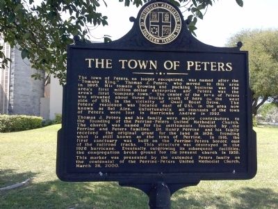
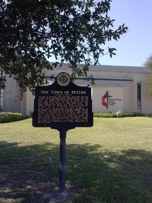
The Town of Peters
Thomas J. Peters and his family were major contributors to the founding of the Perrine-Peters United Methodist Church. The church was named for the settlements founded by the Perrine and Peters families. Dr. Henry Perrine and his family received the original grant for the land in 1838, founding what is still known as the town of Perrine. In 1916, the first sanctuary was built on the Perrine-Peters border, east of the railroad tracks. This structure was destroyed in the 1926 hurricane. Eventually outgrowing its subsequent facilities, the congregation broke ground for the present church in 1958. This marker was presented by the extended Peters family on the centennial of the Perrine-Peters United Methodist Church, March 26, 2000.
Erected 2000 by The Historical Association of Southern Florida.
Topics. This historical marker is listed in these topic lists: Agriculture • Churches & Religion • Industry & Commerce • Settlements & Settlers. A significant historical date for this entry is March 26, 2000.
Location. 25° 36.03′ N, 80° 21.181′ W. Marker is in Palmetto Bay, Florida, in Miami-Dade County. Marker is at the intersection of South Dixie Highway (U.S. 1) and SW 183rd Street, on the right when traveling north on South Dixie Highway. Touch for map. Marker is at or near this postal address: 18301 S Dixie Hwy, Miami FL 33157, United States of America. Touch for directions.
Other nearby markers. At least 8 other markers are within 4 miles of this marker, measured as the crow flies. The Perrine Land Grant (approx. 1.3 miles away); Old Cutler Road (approx. 2.3 miles away); Deering Estate (approx. 3 miles away); Richmond Naval Air Station (approx. 3.1 miles away); Chinese Bridge (approx. 3.1 miles away); Naval Air Station Richmond (approx. 3.2 miles away); Ferdinand Magellan (approx. 3.2 miles away); Miami Serpentarium (approx. 3.9 miles away). Touch for a list and map of all markers in Palmetto Bay.
Credits. This page was last revised on June 16, 2016. It was originally submitted on February 10, 2014, by Marsha A. Matson of Palmetto Bay, Florida. This page has been viewed 1,170 times since then and 66 times this year. Photos: 1, 2, 3. submitted on May 4, 2014, by Marsha A. Matson of Palmetto Bay, Florida. • Bernard Fisher was the editor who published this page.


