Near Murfreesboro in Rutherford County, Tennessee — The American South (East South Central)
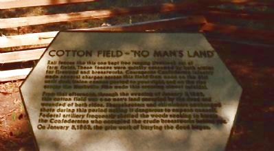
Cotton Field – "No Man's Land"
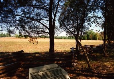
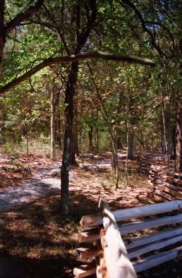
Rail fences like this one kept free ranging livestock out of farm fields. These fences were quickly consumed by both armies for firewood and breastworks. Courageous Confederate infantry made several charges across this field from noon on the 31st until dusk. Union cannon posted to your right, and on the rise across the Nashville Pike made this crossing almost suicidal.
From that afternoon, through the evening of January 3, 1863, this cotton field was a no man's land occupied by the dead and wounded of both sides. Sharpshooters and skirmishers exchanged shots during this period making it dangerous to expose oneself. Federal artillery frequently shelled the woods seeking to harass the Confederates who occupied the crude breastworks behind you. On January 5, 1868, the grim work of burying the dead began.
Topics. This historical marker is listed in this topic list: War, US Civil. A significant historical date for this entry is January 3, 1863.
Location. Marker has been reported permanently removed. It was located near 35° 52.528′ N, 86° 25.958′ W. Marker was near Murfreesboro, Tennessee, in Rutherford County. Marker could be reached from Park Road, 0.8 miles north of North Thompson Lane, on the left when traveling north. The marker is on the trail to Tour Stop 3, "The Cotton Field." It is around 600 feet westbound off the Park Road from a parking lot of four spaces. The view from the marker looks north across a field bounded by forest and the Old Nashville Road to the east. The Stones River Visitor Center is visible in the distance. Touch for map. Marker was at or near this postal address: 1563 North Thompson Lane, Murfreesboro TN 37129, United States of America.
We have been informed that this sign or monument is no longer there and will not be replaced. This page is an archival view of what was.
Other nearby markers. At least 8 other markers are within walking distance of this location. This Far, But No Farther (about 400 feet away, measured in a direct line); Parsons' Batteries Heavily Engaged (about 600 feet away); Exploring the Promise of Freedom (about 600 feet away); Waiting Anxiously for Tomorrow's Fate (about 700 feet away); The Fight for the Cedars (about 800 feet away); The Federals' Final Rally Turns the Tide (about 800 feet away); Anchoring the Union Line (approx. ¼ mile away); Remembering Sacrifices - in Stone (approx. ¼ mile away). Touch for a list and map of all markers in Murfreesboro.
Also see . . . Stones River National Battlefield. (Submitted on February 10, 2014.)
Credits. This page was last revised on April 9, 2021. It was originally submitted on February 10, 2014, by David Graff of Halifax, Nova Scotia. This page has been viewed 886 times since then and 50 times this year. Last updated on March 13, 2021, by Shane Oliver of Richmond, Virginia. Photos: 1, 2, 3. submitted on February 10, 2014, by David Graff of Halifax, Nova Scotia. • Bill Pfingsten was the editor who published this page.


