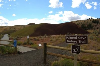
Near Mitchell in Wheeler County, Oregon — The American West (Northwest)
Look Below the Surface
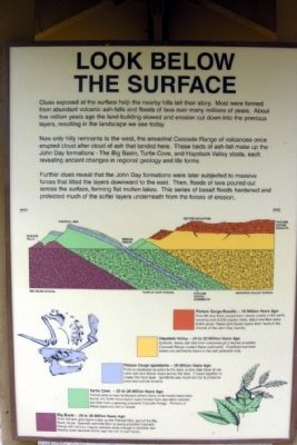
Now only hilly remnants to the west, the ancestral Cascade Range of volcanoes once erupted cloud after cloud of ash that landed here. These beds of ash-fall make up the John Day formations - The Big Basin, Turtle Cove, and Haystack Valley strata, each revealing ancient changes in regional geology and life forms.
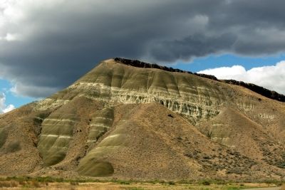
Further clues reveal that the John Day formations were later subjected to massive forces that tilted the layers downward to the east. Then, floods of lava poured out across the surface, forming flat molten lakes. This series of basalt floods hardened and protected much of the softer layers underneath from the forces of erosion.
Picture Gorge Basalts – 16 Million Years Ago
Over 60 lava flows issued from nearby cracks in the earth, covering over 2,000 square miles, about one flow every 8,000 years. These dark basalt layers form much of the rimrock of the John Day country.
Haystack Valley – 20 to 22 Million Years Ago
Episodic, heavy ash-falls from volcanoes of a mature ancestral Cascade Range created these sediments. Fossilized mammal bones are commonly found in this soft yellowish rock.
Picture Gorge Ignimbrite – 28 Million Years Ago
From an explosive eruption to the west, a fiery tidal wave of volcanic ash and debris raced across the land. It fused together to create this hard layer. Ignimbrite was much too hot to preserve plant and animal remains.
Turtle Cove – 22 to 28 Million Years Ago
Named after a cove landscape where many turtle fossils have been found, the Turtle Cove layers were formed from abundant volcanic ash-fall from a growing ancestral Cascade Range. Portions of these layers are rich in fossils.
Big Basin – 28 to 39 Million Years Ago
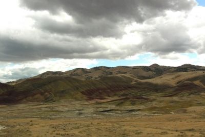
Vivid red and gold layers make up the Painted Hills, part of the Big Basin strata. Sporadic ash-falls from a young ancestral Cascade Range did not bury organic remains deep enough to fossilize well. Nearby pond deposits of this age are rich in leaf fossils.
Topics. This historical marker is listed in this topic list: Natural Features.
Location. 44° 39.24′ N, 120° 15.096′ W. Marker is near Mitchell, Oregon, in Wheeler County. Marker can be reached from Bear Creek Road, 0.4 miles west
of Bridge Creek - Burnt Ranch Road. Marker is located in the Painted Hills Unit of John Day Fossil Beds National Monument at the end of the road to the picnic area; the above directions are to the intersection of Bear Creek Road and the picnic area road. Touch for map. Marker is in this post office area: Mitchell OR 97750, United States of America. Touch for directions.
Other nearby markers. At least 8 other markers are within 10 miles of this marker, measured as the crow flies. Fossils on the Frontier (here, next to this marker); A Matter of Survival (approx. 0.8 miles away); Deciphering the Forest (approx. 0.8 miles away); Pieces of the Puzzle (approx. 0.8 miles away); Painted Hills Overlook (approx. 0.8 miles away); Painted by the Past (approx. 0.8 miles away); Who was John Day? (approx. 0.8 miles away); H.H. Wheeler (approx. 9.9 miles away). Touch for a list and map of all markers in Mitchell.
Also see . . . John Day Fossil Beds National Monument. Official National Park Service website. (Submitted on February 11, 2014.)
Credits. This page was last revised on June 16, 2016. It was originally submitted on February 11, 2014, by Duane Hall of Abilene, Texas. This page has been viewed 372 times since then and 6 times this year. Photos: 1, 2, 3, 4, 5. submitted on February 11, 2014, by Duane Hall of Abilene, Texas.
Editor’s want-list for this marker. Photo of wide-view of marker and surroundings. • Can you help?
