
Gallaudet in Northeast Washington in Washington, District of Columbia — The American Northeast (Mid-Atlantic)
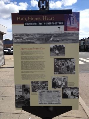
Provisions for the City
Hub, Home, Heart
| — | Greater H Street NE Heritage Trail | — |
Photographed by Craig Swain, September 29, 2012
1. Provisions for the City Marker
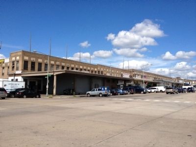
This high ground near the B&O Railroad tracks has been Union Terminal Market since 1931. That year Center Market on Pennsylvania Avenue, NW, came down to make way for the National Archives. Vendors seeking new locations clustered here.
Before the market arrived, this land was part of the Brentwood estate, and then the World War I-era Camp Meigs, an army training post. In the 1920s the Hechinger lumber yard replaced the camp. With the railroad so convenient, traveling circuses occasionally set up here.
Jewish, Greek, Italian, and African American vendors dominated the original market, including Fred Kolker and his Kolker Poultry. In the late 1950s, more businesses arrived as urban renewal closed the Southwest wholesale market. Among them was Washington Beef Company, belonging to Fred Kolker's uncle Sam. Every week Washington Beef employees unloaded and butchered five rail cars of beef carcasses for distribution to such customers as the Hot Shoppes and DC Public Schools. And each night a crew cleaned equipment to prepare for the federal inspector's regular morning visit. Sam's six sons and grandsons continued the business
this page online
A new wave of immigrant entrepreneurs, especially from China, El Salvador, Jamaica, and Korea, came in the 1980s.
Civil rights activist Nadine Winter, concerned about homeless people at the market, created Hospitality House to assist them. In 1962 Hospitality House opened a family shelter at 507 Florida Avenue. Winter later helped establish a community credit union on H Street, worked for federally supported urban homesteading, and, in 1974, was elected to the first of four terms on the DC City Council, representing Ward 6.
Erected 2012 by Cultural Tourism DC. (Marker Number 7.)
Topics and series. This historical marker is listed in these topic lists: Civil Rights • Industry & Commerce • Railroads & Streetcars. In addition, it is included in the Greater H Street Heritage Trail series list. A significant historical year for this entry is 1931.
Location. 38° 54.415′ N, 76° 59.979′ W. Marker is in Northeast Washington in Washington, District of Columbia. It is in Gallaudet. It is at the intersection of Florida Avenue Northeast and 5th Street Northeast, on the right when traveling west on Florida Avenue Northeast.
Photographed by Craig Swain, September 29, 2012
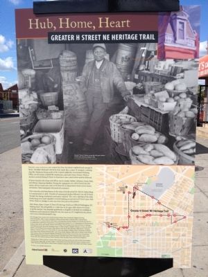
2. Back of Marker

Regionally, this marker is in the Washington Metropolitan Area. It is also in the American Northeast, in the Upper South, in the Mid-Atlantic, in the Tidewater, and in the Chesapeake Bay Region. Globally, it is in North America, the Western Hemisphere, the Western World, and the Anglosphere.
Other nearby markers. At least 8 other markers are within walking distance of this marker: Kolker Poultry Company (about 300 feet away, measured in a direct line); Ballard House (about 800 feet away); The Edward Miner Gallaudet Residence (about 800 feet away); Winds of Evolution, 2022 (approx. 0.2 miles away); Helen Fay House (approx. 0.2 miles away); Denison House (approx. 0.2 miles away); Untitled (Brainwash) (approx. 0.2 miles away); 1964 (approx. 0.2 miles away). Touch for a list and map of all markers in Northeast Washington.
Other markers no longer nearby. The Iceman's Arena (was about 800 feet away but has been confirmed missing); Black Girl Ventures x Nike: Entrepreneurship is a Boxing Match (was approx.
Photographed by Craig Swain, September 29, 2012
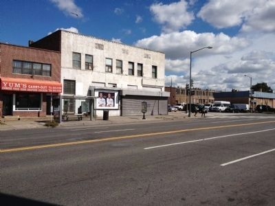
3. Looking across Florida Avenue at the marker
Also see . . . About Union Market District. District website entry (Submitted on October 4, 2012, by Craig Swain of Leesburg, Virginia.)
Photographed by Craig Swain, September 29, 2012
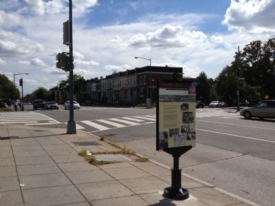
4. Provisions for the City Marker
Photographed by Craig Swain, September 29, 2012
5. The Market
Credits. This page was last revised on December 5, 2023. It was originally submitted on October 4, 2012, by Craig Swain of Leesburg, Virginia. This page has been viewed 939 times since then and 17 times this year. Last updated on February 11, 2014, by A. Taylor of Laurel, Maryland. Photos: 1, 2, 3, 4, 5. submitted on October 4, 2012, by Craig Swain of Leesburg, Virginia. • Bill Pfingsten was the editor who published this page.
