Atlas District in Northeast Washington in Washington, District of Columbia — The American Northeast (Mid-Atlantic)
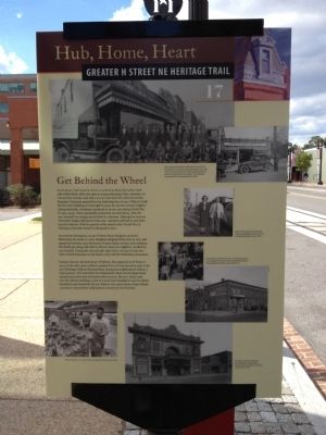
Get Behind the Wheel
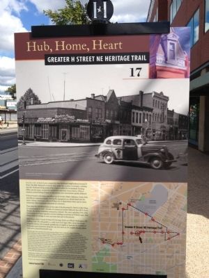
Hub, Home, Heart
— Greater H Street NE Heritage Trail —
Ourisman Chevrolet once occupied almost the entire north side of this block. After two years as a top-performing Chevy salesman on Connecticut Avenue, and with a $2,000 loan from his widowed mother, Benjamin Ourisman opened his own dealership here in 1921. When he built the five-story building on your right in 1940, his was the country's highest-selling dealership. Ourisman continued to service cars during World War II (1941-1945), when automobile production was shut down. After the war, demand was so high that he hired 67 salesmen. Although he received Chevrolet's largest allotment of new cars, customers still had to wait three years for delivery. With the growth of the suburbs after World War II, Ourisman Chevrolet moved to Maryland in 1962.
Across from Ourisman's, at 619 H Street, Pietro Borghese ran Pete's Barbershop for nearly 50 years. Borghese emigrated from Italy in 1920 and opened his business near the homes of many Italian workers and craftsmen. The family got along well with its African American neighbors, recalled his son Carmelo. During the riots of 1968, when Pete's was one of only two white-owned businesses on the block, rioters left the barbershop untouched.
Sanitary Grocery, the forerunner of Safeway, first appeared on H Street in 1909. In the early 1960s, Safeway opened at 600 H, but moved in 1983 to the new Hechinger Mall on Benning Road, leaving the neighborhood without a major grocery. Five years later the independent, black-owned Mega Foods opened across the street but lasted only two years. Murry's, which took over the Safeway building, is part of a local chain founded in 1948 by Alfred Mendelson and named for his son. Murry's two-ounce frozen steaks offered consumers conveniently small portions of meat for the first time.
Erected 2012 by Cultural Tourism DC. (Marker Number 17.)
Topics and series. This historical marker is listed in these topic lists: Industry & Commerce • Roads & Vehicles. In addition, it is included in the Greater H Street Heritage Trail series list. A significant historical year for this entry is 1921.
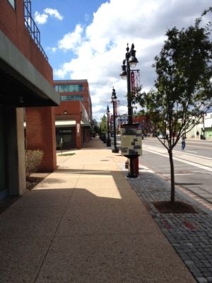
Location. 38° 54.007′ N, 76° 59.81′ W. Marker is in Northeast Washington in Washington, District of Columbia. It is in the Atlas District. Marker is at the intersection of H Street Northeast and 7th Street Northeast, on the right when traveling east on H Street Northeast. Touch for map. Marker is at or near this postal address: 640 H Street Northeast, Washington DC 20002, United States of America. Touch for directions.
Other nearby markers. At least 8 other markers are within walking distance of this marker. The Fires of 1968 (about 300 feet away, measured in a direct line); Sanctuaries (about 400 feet away); At the Crossroads (about 500 feet away); Cathy Hughes (approx. 0.2 miles away); Life on H Street (approx. ¼ mile away); Community Caretakers (approx. ¼ mile away); The Changing Faces of H Street (approx. ¼ mile away); Greater Pleasant Grove Baptist Church (approx. 0.3 miles away). Touch for a list and map of all markers in Northeast Washington.
Credits. This page was last revised on January 30, 2023. It was originally submitted on October 7, 2012, by Craig Swain of Leesburg, Virginia. This page has been viewed 539 times since then and 30 times this year. Last updated on February 11, 2014, by A. Taylor of Laurel, Maryland. Photos: 1, 2, 3. submitted on October 7, 2012, by Craig Swain of Leesburg, Virginia. • Bill Pfingsten was the editor who published this page.


