Near Mitchell in Wheeler County, Oregon — The American West (Northwest)
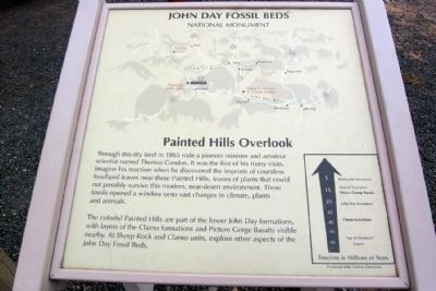
Painted Hills Overlook
John Day Fossil Beds National Monument
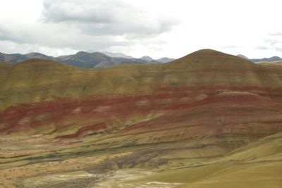
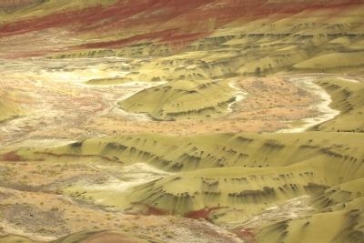
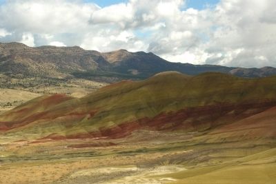
The colorful Painted Hills are part of the lower John Day formations, with layers of the Clarno formations and Picture Gorge Basalts visible nearby. At Sheep Rock and Clarno units, explore other aspects of the John Day Fossil Beds.
Erected by National Park Service.
Topics. This historical marker is listed in these topic lists: Environment • Paleontology. A significant historical year for this entry is 1865.
Location. 44° 38.99′ N, 120° 16′ W. Marker is near Mitchell, Oregon, in Wheeler County. Marker can be reached from Bear Creek Road, 1.2 miles west of Bridge Creek - Burnt Ranch Road. Marker is located in the Painted Hills Unit of John Day Fossil Beds National Monument at the end of the road to the Painted Hills Overlook parking lot and trailhead; the above directions are to the intersection of Bear Creek Road and the Painted Hills Overlook road. Touch for map. Marker is in this post office area: Mitchell OR 97750, United States of America. Touch for directions.
Other nearby markers. At least 8 other markers are within 11 miles of this marker, measured as the crow flies. Pieces of the Puzzle (here, next to this marker); Deciphering the Forest (here, next to this marker); A Matter of Survival (here, next to this marker); Painted by the Past (here, next to this marker); Who was John Day? (here, next to this marker); Fossils on the Frontier (approx. 0.8 miles away); Look Below the Surface (approx. 0.8 miles away); H.H. Wheeler (approx. 10.3 miles away). Touch for a list and map of all markers in Mitchell.
Credits. This page was last revised on October 20, 2020. It was originally submitted on February 12, 2014, by Duane Hall of Abilene, Texas. This page has been viewed 855 times since then and 8 times this year. Photos: 1, 2, 3, 4. submitted on February 12, 2014, by Duane Hall of Abilene, Texas.
Editor’s want-list for this marker. Photo of wide-view of marker and surroundings. • Can you help?


