Near Joseph in Wallowa County, Oregon — The American West (Northwest)
A Story Written in Stone
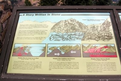
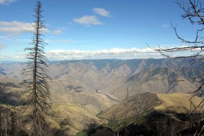
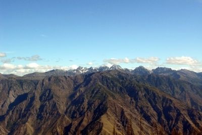
Today’s landscape is just the most recent chapter. For over 6 million years, tremendous forces within the earth have been gradually uplifting the Wallowa and Seven Devils Mountains. Hells Canyon was carved during the last 2 million years, by a Snake River much more powerful that we know it today.
But the story of this landscape is a long, complex one. Take a trip back in time some 300 million years to see where it began.
Chapter One: An Island Arc Is Born
300 to 130 Million Years Ago
Between 300-220 million years ago, two oceanic plates in the South Pacific converged violently. Lava spewed from the ocean floor and the Blue Mountain Island Arc emerged. Then the island volcanoes lay dormant. From 210-130 million years ago, the island arc migrated, inch by inch, some 2000 miles northward on a moving plate on the earth’s crust.
Chapter Two: Collision And Erosion
130 to 17 Million Years Ago
About 130-100 million years ago, the island arc collided with the ancient North American continent. When it “docked,” it forced up the mountains of central Idaho and displaced the Pacific Ocean to the west. The leading edge of the oceanic plate, was forced downward, as it slid under the continental plate.
Chapter Three: Plateau Basalt
17 to 6 Million Years Ago
Lava flows poured from great cracks in the earth, burying the eroded landscape and filling in streambeds and other irregularities in the earth’s surface. Flow after flow blanketed the Hells Canyon region until a nearly level plateau was created. Known as the Columbia River Basalts, these lava flows covered about 70,000 square miles in Oregon, Washington and western Idaho.
Chapter Four: Uplifting and Canyon Cutting
6 Million Years Ago to Present
Erected by United States Forest Service.
Topics. This historical marker is listed in this topic list: Natural Features.
Location. 45° 7.433′ N, 116° 50.112′ W. Marker is near Joseph, Oregon, in Wallowa County. Marker can be reached from National Forest Service Road 490, 2 miles east of Wallowa Mountain Loop (Forest Service Road 39). Marker is located at the Hells Canyon Overlook vista area east of the parking lot. Touch for map. Marker is in this post office area: Joseph OR 97846, United States of America. Touch for directions.
Other nearby markers. At least 4 other markers are within 6 miles of
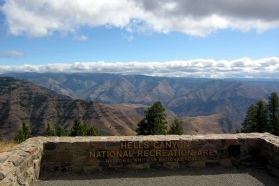
this marker, measured as the crow flies. Land Of Fire And Water (here, next to this marker); Hells Canyon National Recreation Area (within shouting distance of this marker); Look Over Hells Canyon ... (within shouting distance of this marker); The Bonneville Expedition (approx. 5.9 miles away).
Also see . . . Hells Canyon National Recreation Area. Official US Forest Service website. (Submitted on February 14, 2014.)
Credits. This page was last revised on June 16, 2016. It was originally submitted on February 14, 2014, by Duane Hall of Abilene, Texas. This page has been viewed 422 times since then and 9 times this year. Photos: 1, 2, 3, 4. submitted on February 14, 2014, by Duane Hall of Abilene, Texas.
Editor’s want-list for this marker. Photo of wide-view of marker and surroundings. • Can you help?


