Kula in Maui County, Hawaii — Hawaiian Island Archipelago (Pacific Ocean)
Pa Ka‘oao
White Hill Trail
| — | Haleakala National Park | — |
Photographed by Don Morfe, November 6, 2008
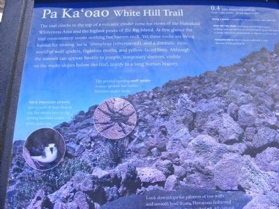
1. Pa Ka'oao White Hill Trail Marker
‘Ua‘u (Hawaiian petrels) spend most of their lives at sea, but return here to dig nesting burrows under rocky outcrops.
The ground-hunting wolf spider weaves no web but builds burrows under rocks.
0.4 mile round trip (643 m)-Steep, rock uneven, 140 feet elevation gain.
Bring a jacket - conditions can turn windy, wet and cold.
Stay on the trail. And leave everything in place: shifting rocks can destroy an animal’s home, sever the root of a young ‘āhinahina (silversword), or disturb a cultural site.
Keonehe‘ehe‘e (Sliding Sands trailhead is near the end of the parking lot.
Erected by National
this page online
Topics. This historical marker is listed in these topic lists: Animals • Environment.
Location. 20° 42.828′ N, 156° 15.006′ W. Marker is in Kula, Hawaii, in Maui County. It is on Crater Road. The marker is near the Red Hill Summit Observation and Exhibition Building. Touch for map. Marker is in this post office area: Kula HI 96790, United States of America. Touch for directions.

Regionally, this marker is in Upcountry Maui. Globally, it is in North America, in Polynesia, in the Pacific Ocean, in North Pacific, on the Pacific Rim, in the Western Hemisphere, in the Western World, and in the Anglosphere.
Other nearby markers. At least 8 other markers are within 11 miles of this marker, measured as the crow flies: Haleakalā National Park (about 400 feet away, measured in a direct line); Ranch Wall (approx. 2½ miles away); Behold, Hawai'i (approx. 3.2 miles away); Hawaiian Goose or Nene (Nay-Nay) (approx. 3.2 miles away); Wind, Wave and Wings (approx. 3.2 miles away); Stephen Tyng Mather (approx. 3.2 miles away);
Photographed by Don Morfe, November 6, 2008
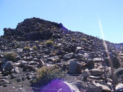
2. Pa Ka'oao White Hill Trail Marker
Credits. This page was last revised on January 25, 2021. It was originally submitted on February 15, 2014, by Don Morfe of Baltimore, Maryland. This page has been viewed 920 times since then and 18 times this year. Photos: 1, 2. submitted on February 15, 2014, by Don Morfe of Baltimore, Maryland. • Bill Pfingsten was the editor who published this page.
