Canadian in Hemphill County, Texas — The American South (West South Central)
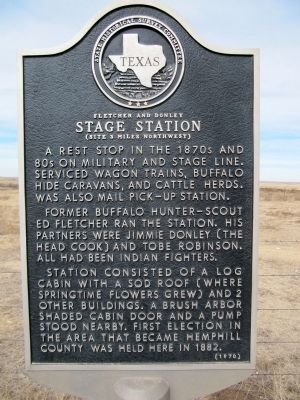
Fletcher and Donley Stage Station
(Site 3 miles northwest)
A rest stop in the 1870s and 80s on military and stage line. Serviced wagon trains, buffalo hide caravans, and cattle herds. Was also mail pick-up station.
Former buffalo hunter-scout Ed Fletcher ran the station. His partners were Jimmie Donley (the head cook) and Tobe Robinson. All had been Indian fighters.
Station consisted of a log cabin with a sod roof (where springtime flowers grew) and 2 other buildings. A brush arbor shaded cabin door and a pump stood nearby. First election in the area that became Hemphill County was held here in 1882.
Erected 1970 by State Historical Survey Committee. (Marker Number 1917.)
Topics. This historical marker is listed in these topic lists: Settlements & Settlers • Wars, US Indian. A significant historical year for this entry is 1882.
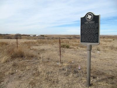
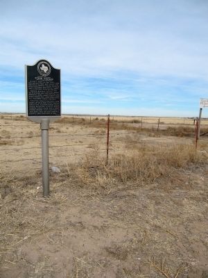
Location. 35° 41.536′ N, 100° 16.396′ W. Marker is in Canadian, Texas, in Hemphill County. Marker is at the intersection of Farm to Market Road 277 and County Route 15, on the left when traveling east on Route 277. Touch for map. Marker is in this post office area: Canadian TX 79014, United States of America. Touch for directions.
Other nearby markers. At least 8 other markers are within 11 miles of this marker, measured as the crow flies. Buffalo Wallow Battle Ground (approx. one mile away); Gageby Cemetery (approx. 4.1 miles away); Washita Cemetery (approx. 5 miles away); Gen. Nelson Miles Expedition (approx. 6.4 miles away); Zybach Cemetery (approx. 6.8 miles away); Cataline Cemetery (approx. 7.2 miles away); Site of Lyman's Wagon Train Battle (approx. 7.9 miles away); Route of Marcy Trail (approx. 10.9 miles away). Touch for a list and map of all markers in Canadian.
Credits. This page was last revised on November 25, 2020. It was originally submitted on February 16, 2014, by Marvin Seibert of Ketchikan, Alaska. This page has been viewed 618 times since then and 19 times this year. Photos: 1, 2, 3. submitted on February 16, 2014, by Marvin Seibert of Ketchikan, Alaska. • Bernard Fisher was the editor who published this page.


