Near Screamer in Henry County, Alabama — The American South (East South Central)
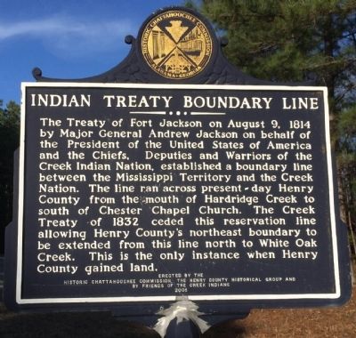
Indian Treaty Boundary Line
Erected 2005 by the Historic Chattahoochee Commission, The Henry County Historical Group and by Friends of the Creek Indians.
Topics and series. This historical marker is listed in these topic lists: Native Americans • Peace • Political Subdivisions. In addition, it is included in the Former U.S. Presidents: #07 Andrew Jackson series list. A significant historical year for this entry is 1814.
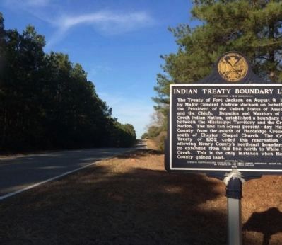
Location. 31° 42.905′ N, 85° 11.004′ W. Marker is near Screamer, Alabama, in Henry County. Marker is on Alabama Route 95, 0.4 miles south of County Road 48, on the left when traveling south. Touch for map. Marker is in this post office area: Abbeville AL 36310, United States of America. Touch for directions.
Other nearby markers. At least 8 other markers are within 10 miles of this marker, measured as the crow flies. A different marker also named Indian Treaty Boundary Line (approx. 2.4 miles away); Liberty United Methodist Church / Hilliardsville (approx. 2.6 miles away); A Revolutionary Soldier (approx. 2.6 miles away); New Lowell United Methodist Church / New Lowell School (approx. 5˝ miles away in Georgia); Lawrenceville / Lawrenceville Academy (approx. 6.3 miles away); Freemount Junior High School (approx. 6.7 miles away); McGee~Reeder Home (approx. 8.3 miles away); 1814 Boundary / Founding of Fort Gaines (approx. 10 miles away in Georgia). Touch for a list and map of all markers in Screamer.
Credits. This page was last revised on August 4, 2020. It was originally submitted on February 17, 2014, by Mark Hilton of Montgomery, Alabama. This page has been viewed 960 times since then and 42 times this year. Photos: 1. submitted on February 17, 2014, by Mark Hilton of Montgomery, Alabama. 2. submitted on February 26, 2014, by Mark Hilton of Montgomery, Alabama. • Bernard Fisher was the editor who published this page.

