Near Sharpsburg in Washington County, Maryland — The American Northeast (Mid-Atlantic)
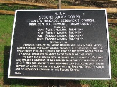
Second Army Corps
Howard's Brigade, Sedgwick's Division
Second Army Corps.
Howard's Brigade, Sedgwick's Division,
Brig. Gen. O.O. Howard, Commanding,
Organization.
69th Pennsylvania Infantry,
71st Pennsylvania Infantry,
72d Pennsylvania Infantry,
106th Pennsylvania Infantry.
September 17, 1862.
Howard's Brigade following Gorman and Dana in their attack, passed through the East Woods, crossed the Cornfield and the Hagerstown Pike and reached the edge of the West Woods, where its advance was checked about 90 yards east of this point.
Its left flank having been attacked and turned by McLaws' and Walker's Divisions, it was forced to retire to the fields north of D.R. Miller's, where it was reformed and placed in position in support of part of the artillery of the First and Twelfth Corps and of Sedgwick's Division of the Second Corps.
Erected by Antietam Battlefield Board. (Marker Number 39.)
Topics and series. This historical marker is listed in this topic list: War, US Civil. In addition, it is included in the Antietam Campaign War Department Markers series list. A significant historical month for this entry is September 1808.
Location. 39° 28.688′ N, 77° 45.096′ W. Marker is near Sharpsburg, Maryland, in Washington County. Marker is on Hagerstown Pike (State Highway 65), on the right when traveling north. Located at stop 4 of the West Woods walking trail. Touch for map. Marker is in this post office area: Sharpsburg MD 21782, United States of America. Touch for directions.
Other nearby markers. At least 8 other markers are within walking distance of this marker. A different marker also named Second Army Corps (here, next to this marker); a different marker also named Second Army Corps (a few steps from this marker); Ewell's Division, Jackson's Command (a few steps from this marker); 15th Massachusetts Volunteer Infantry (within shouting distance of this marker); John Lemuel Stetson (within shouting distance of this marker); Jackson's Command (within shouting distance of this marker); Longstreet's Command (about 300 feet away, measured in a direct line); a different marker also named Jackson's Command (about 400 feet away). Touch for a list and map of all markers in Sharpsburg.
Related markers. Click here for a list of markers that are related to this marker. Philadelphia Brigade on Monuments and Tablets.
Also see . . .
1. Antietam Battlefield. National Park Service site. (Submitted on April 17, 2008, by Craig Swain of Leesburg, Virginia.)
2. 2nd Brigade, 2nd Division, II Corps. Also known as the Philadelphia Brigade. Howard relieved General Sedgwick as division commander when the later was wounded. Col. Joshua Owen of the 69th Pennsylvania
assumed command of the Brigade at that time. Of the battle, Owen wrote, The panic which I had observed on the left ultimately spread along the line, and the impetuous advance of the enemy's column threatened to turn our left flank. (Submitted on April 17, 2008, by Craig Swain of Leesburg, Virginia.)

Photographed By Craig Swain, March 29, 2008
3. The Left Wing of Howard's Brigade
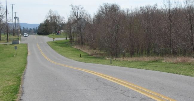
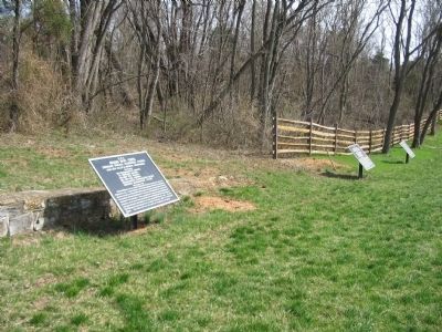
The 69th and 72nd Pennsylvania Infantry entered the central portion of the West Woods at a section fronting the Hagerstown Pike (present day Dunker Church Road). In the background is the Dunker Church. With the powerful Confederate attack into the woods turning the Federal flank, both regiments fell back initially to positions just south of the cornfield. Note the pedestals for two War Department tablets along the road. These were taken down for maintenance in the winter of 2008.

Photographed By Craig Swain, April 6, 2008
4. Right Flank of Howard's Brigade
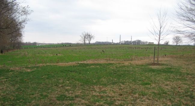
Looking north from the trailhead for the West Woods walking trail. The 71st and 106th Pennsylvania passed across the open ground, into the northern section of the West Woods. This left a sizable gap between the "wings" of Howard's Brigade, filled by 42nd New York and 7th Michigan of Dana's Brigade.
Credits. This page was last revised on December 7, 2017. It was originally submitted on April 17, 2008, by Craig Swain of Leesburg, Virginia. This page has been viewed 856 times since then and 14 times this year. Photos: 1. submitted on April 17, 2008, by Craig Swain of Leesburg, Virginia. 2. submitted on April 16, 2008, by Craig Swain of Leesburg, Virginia. 3, 4. submitted on April 17, 2008, by Craig Swain of Leesburg, Virginia.

