
Marker Logo
THE HISTORICAL
MARKER DATABASE
“Bite-Size Bits of Local, National, and Global History”
Royalton in Niagara County, New York — The American Northeast (Mid-Atlantic)
 

Chesnut Ridge - Lewiston Road


Chesnut Ridge - Lewiston Road Marker image. Click for full size.
Photographed by Anton Schwarzmueller, March 3, 2014
1. Chesnut Ridge - Lewiston Road Marker
U.S. Bicentennial symbol on marker at top.
Inscription. An old Indian trail used by travelers to Fort Niagara, widened for wagon use about 1800, later a stage route from Batavia to Niagara.
 
Topics and series. This historical marker is listed in this topic list: Roads & Vehicles. In addition, it is included in the The Spirit of ’76, America’s Bicentennial Celebration series list. A significant historical year for this entry is 1800.
 
Location. 43° 9.934′ N, 78° 34.312′ W. Marker is in Royalton, New York, in Niagara County. It is at the intersection of Chestnut Ridge Road (New York State Route 77) and Gasport Road, on the right when traveling south on Chestnut Ridge Road. Marker is in the Town of Royalton, Post Office Gasport, just east of Gasport Road. Touch for map. Marker is at or near this postal address: 8404 Chestnut Ridge Road, Gasport NY 14067, United States of America. Touch for directions.

Regionally, this marker is in Upstate New York, specifically in Western New York, and in the Buffalo Metropolitan Area. It is also in the American Northeast, on the Great Lakes, and in the Mid-Atlantic. Globally, it is in North America, the Western Hemisphere, the Western World,
Paid Advertisement
Click or scan to see
this page online
and the Anglosphere. Historically, it finds itself in what was once the Viceroyalty of New France, the Haudenosaunee (Iroquois) Confederacy, New Netherland, and one of the original Thirteen Colonies.

Other nearby markers. At least 8 other markers are within 3 miles of this marker, measured as the crow flies: Abdullah (approx. 1.8 miles away); Academy 1850-70 (approx. 2.2 miles away); 150th Anniversary (approx. 2.3 miles away); Veterans Memorial (approx. 2.3 miles away); Gasport (approx. 2.4 miles away); Site of First Christian Society of Royalton (approx. 2.9 miles away); Church Site of First Christian Society of Royalton (approx. 2.9 miles away); Mill District (approx. 3 miles away). Touch for a list and map of all markers in Royalton.
 
More about this marker. This portion of NY Route 77 is generally compass East-West, but the route is marked entirely North-South.
 
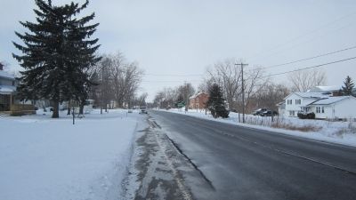
Eastward View Chestnut Ridge - Lewiston Road Marker image. Click for full size.
Photographed by Anton Schwarzmueller, March 3, 2014
2. Eastward View Chestnut Ridge - Lewiston Road Marker
NY Route 77 southbound, compass east.
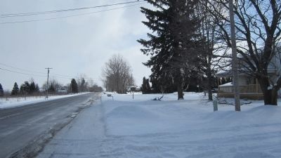
Westward View Chestnut Ridge - Lewiston Road Marker image. Click for full size.
Photographed by Anton Schwarzmueller, March 3, 2014
3. Westward View Chestnut Ridge - Lewiston Road Marker
NY Route 77 north, compass west.
 
 
Credits. This page was last revised on June 26, 2025. It was originally submitted on March 4, 2014, by Anton Schwarzmueller of Wilson, New York. This page has been viewed 853 times since then and 14 times this year. Photos:   1, 2, 3. submitted on March 4, 2014, by Anton Schwarzmueller of Wilson, New York. • Bill Pfingsten was the editor who published this page.

m=72105

CeraNet Cloud Computing sponsors the Historical Marker Database.
This website earns income from purchases you make after using our links to Amazon.com. We appreciate your support.
Paid Advertisement
Jul. 17, 2026
