Pensacola in Escambia County, Florida — The American South (South Atlantic)
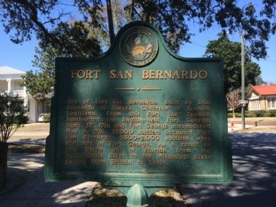
Fort San Bernardo
Erected 1956 by the J.C Penney Company.
Topics. This historical marker is listed in these topic lists: Colonial Era • Forts and Castles. A significant historical date for this entry is April 27, 1763.
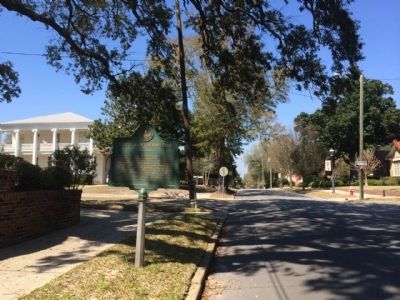
Location. 30° 25.474′ N, 87° 13.259′ W. Marker is in Pensacola, Florida, in Escambia County. Marker is at the intersection of North Spring Street and West Brainerd Street, on the left when traveling north on North Spring Street. Touch for map. Marker is at or near this postal address: 1124 North Spring Street, Pensacola FL 32501, United States of America. Touch for directions.
Other nearby markers. At least 8 other markers are within walking distance of this marker. North Hill Preservation District (approx. 0.2 miles away); Original Site of Pensacola Junior College (approx. 0.4 miles away); Fort George (approx. 0.4 miles away); H & O Café (approx. 0.4 miles away); John Sunday (approx. half a mile away); a different marker also named Fort George (approx. half a mile away); Battle of Pensacola (approx. half a mile away); John Lee Pickens’ Medical Office (approx. half a mile away). Touch for a list and map of all markers in Pensacola.
Also see . . . Pensapedia Wiki entry - Queen's Redoubt. Later called Fort San Bernardo after capture by the Spanish. (Submitted on March 12, 2014, by Mark Hilton of Montgomery, Alabama.)
Credits. This page was last revised on July 17, 2022. It was originally submitted on March 12, 2014, by Mark Hilton of Montgomery, Alabama. This page has been viewed 1,166 times since then and 79 times this year. Photos: 1, 2. submitted on March 12, 2014, by Mark Hilton of Montgomery, Alabama. • Bill Pfingsten was the editor who published this page.

