Bardstown in Nelson County, Kentucky — The American South (East South Central)
An Early Turnpike / Mile Stones, ca. 1835
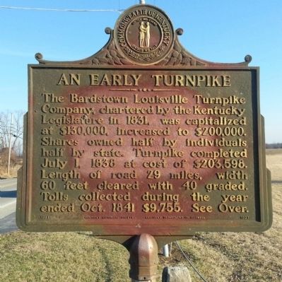
An Early Turnpike
The Bardstown Louisville Turnpike Company, chartered by the Kentucky Legislature in 1831, was capitalized at $130,000, increased to $200,000. Shares owned half by individuals, half by state. Turnpike completed July 1, 1838, at cost of $203,598. Length of road 29 miles, width 60 feet cleared with 40 graded. Tolls collected during the year ended Oct. 1841 $9,755. See Over.
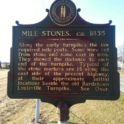
Mile Stones, ca. 1835
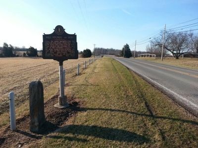
Along the early turnpikes the law required mile posts. Some were cut from stone and some cast in iron. They showed the distance to each end of the turnpike. Typical of the stone markers are 14 along the east side of the present highway, at their approximate initial locations beside the old Bardstown Louisville Turnpike. See Over.
Erected 1967 by Kentucky Historical Society and Kentucky Department of Highways. (Marker Number 1021.)
Topics and series. This historical marker is listed in this topic list: Roads & Vehicles. In addition, it is included in the Kentucky Historical Society series list. A significant historical date for this entry is July 1, 1822.
Location. 37° 51.366′ N, 85° 27.7′ W. Marker is in Bardstown, Kentucky, in Nelson County. Marker is on Louisville Road (U.S. 150) 0.1 miles north of Abbey Ridge, on the right when traveling north. Touch for map. Marker is in this post office area: Bardstown KY 40004, United States of America. Touch for directions.
Other nearby markers. At least 8 other markers are within 3 miles of this marker, measured as the crow flies. Nazareth College (approx. 0.7 miles away); Civil War in Bardstown (approx. 0.8 miles away); Froman’s Road and Station / McGee’s Stone Castle (approx. 1.3 miles away); Ben Johnson House (approx. 1.9 miles away); Daniel Rudd (approx. 2.2 miles away); Cox's Station (approx. 2.3 miles away); My Old Kentucky Home (approx. 2.7 miles away); Salem Academy (approx. 2.8 miles away). Touch for a list and map of all markers in Bardstown.
Credits. This page was last revised on June 16, 2016. It was originally submitted on March 16, 2014, by Bernard Fisher of Richmond, Virginia. This page has been viewed 719 times since then and 42 times this year. Photos: 1, 2, 3, 4. submitted on March 16, 2014, by Bernard Fisher of Richmond, Virginia.


